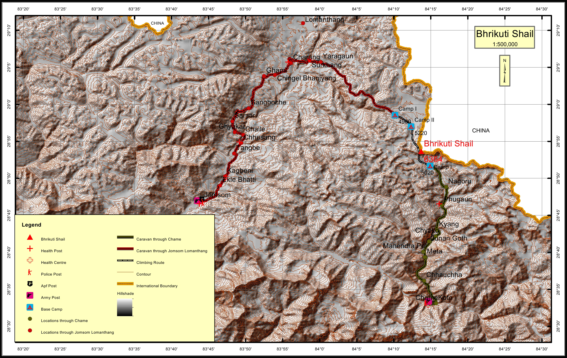
Bhrikuti Shail Overview

Peak ID

BHRS

Status

Opened

Elevation

6364 M / 20879 FT

Latitude

28º 53' 38"

Longitude

84º 13' 42"

History

1st ascent on

16 May, 2005 A.D

1st ascent by

Paulo Grobel,
Denis Flaven,
Bikram Singh,

Location

  • Province:

    Gandaki Pradesh
  • Mountain Range:

    Damodar
  • District:

    Mustang/Manang/NC
  • Municipality/Rural Municipality:

    Dalome/NarPhu/NC

Nearest help center

( from the basecamp along
the caravan route )
  • Police post:

    Kagbeni 80.5KM Chame 44.4KM
  • Armed police post

    Jomsom 89.4KM
  • Army post:

    Jomsom 89.4KM Chame 44.4KM
  • Health centre/post:

    Surkhang 29.6KM Phugaun 12.3KM
  • Tourist police post:

    Jomsom 89.4KM
  • Nearest settlement :

    Yaragaun 25.7KM Nagoru 6.9KM

Royalty Fees

  • Nepalese (NRs):

    Spring 4000, Autumn 2000, Winter/Summer 1000
  • Foreigners (USD):

    Spring 250, Autumn 125, Winter/Summer 70

How to get there

  • From Kathmandu:

    By flight to Pokhara and Jomsom or by drive to Jomsom
  • Caravan route:

    Jomosom-Lo Manthang-Damodar Kunda-BC
  • Caravan route
    length:

    89.4KM through Jomsom, 44.4KM through Chame
  • Climbing route
    length:

    12.1KM through Jomsom, 5.3KM through Chame
  • Duration:

    24 Days

Maps