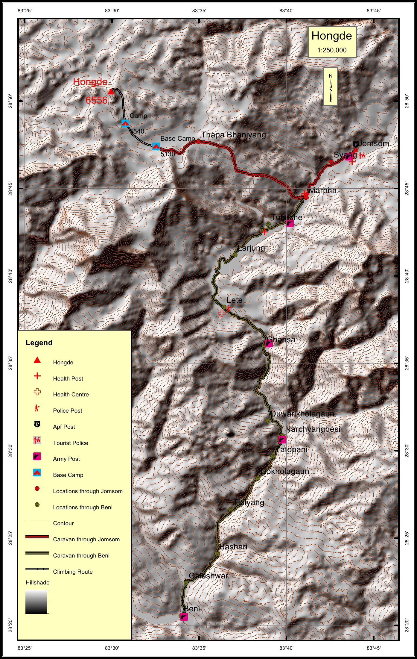
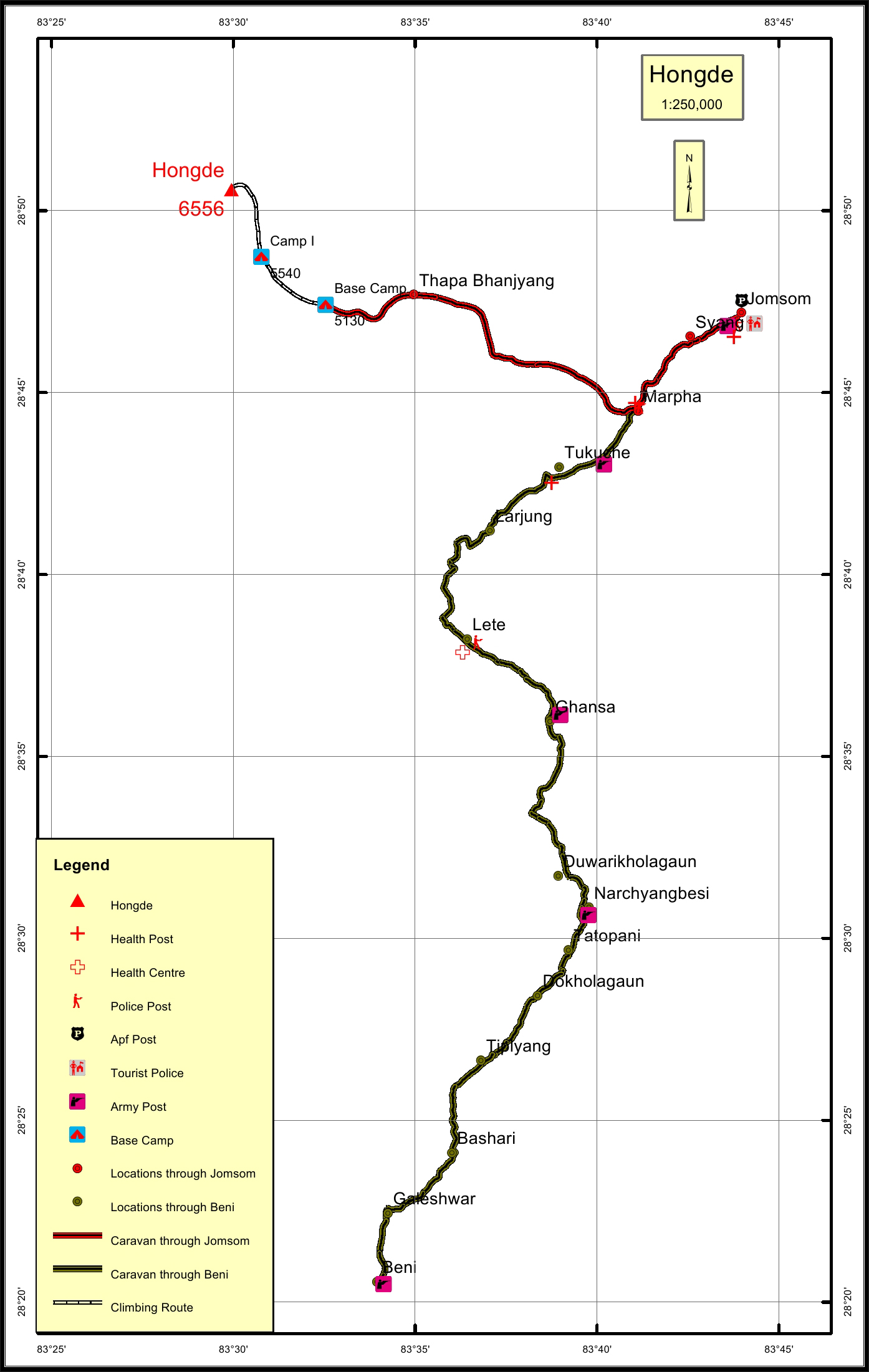
Hongde Overview

Other Name

Hangde

Peak ID

HONG

Status

Opened

Elevation

6556 M / 21509 FT

Latitude

28º 50' 35"

Longitude

83º 29' 57"

History

1st ascent on

May 08,1962

1st ascent by

Shijiro Ishizaka,
Zenkichi Hirayama,
Takashi Miyahara,
Ang Dawa Sherpa,
Ang Temba Sherpa,

Location

  • Province:

    Gandaki Pradesh
  • Mountain Range:

    Damodar
  • District:

    Dolpa/Mustang
  • Municipality/Rural Municipality:

    Chharka Tongsong/Barhagau Muktiksetra

Nearest help center

( from the basecamp along
the caravan route )
  • Police post:

    Marpha 17.7KM
  • Armed police post

    Jomsom 24.9KM
  • Army post:

    Jomsom 24.9KM Ghansa 32.9KM
  • Health centre/post:

    Marpha 17.7KM
  • Tourist police post:

    Jomsom 24.9KM
  • Nearest settlement :

    Marpha 17.7KM

Royalty Fees

  • Nepalese (NRs):

    Spring 5000, Autumn 2500, Winter/Summer 1250
  • Foreigners (USD):

    Spring 400, Autumn 200, Winter/Summer 100

How to get there

  • From Kathmandu:

    By flight to Pokhara and Jomsom or by drive to Jomsom
  • Caravan route:

    Beni-Marpha-Thapa pass-BC\Beni-Dovan-Dhaulagiri-BC
  • Caravan route
    length:

    24.9KM through Jomsom, 78.2KM through Beni
  • Climbing route
    length:

    8.4KM
  • Duration:

    18 Days

Maps