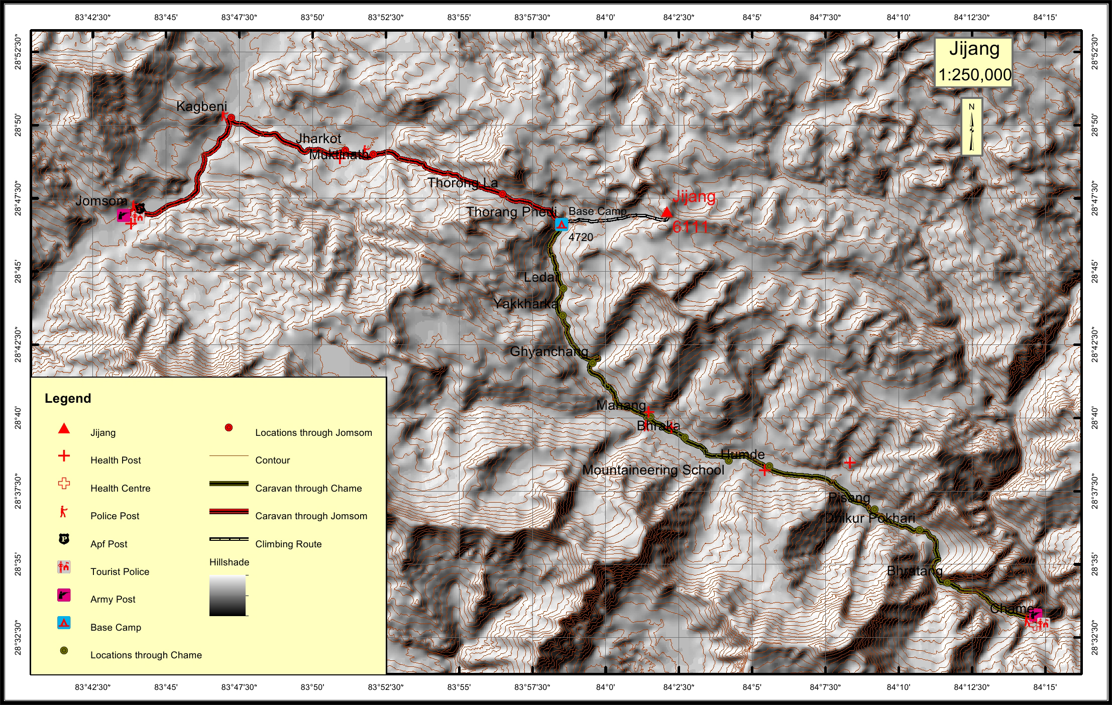
Jijang Overview

Other Name

Gajang, Genjang

Peak ID

JING

Status

Opened

Elevation

6111 M / 20049 FT

Latitude

28º 47' 03"

Longitude

84º 02' 05"

Location

  • Province:

    Gandaki Pradesh
  • Mountain Range:

    Damodar
  • District:

    Manang
  • Municipality/Rural Municipality:

    Nesyang/Nar Phu

Nearest help center

( from the basecamp along
the caravan route )
  • Police post:

    Muktinath 12.3KM Manang 16.1KM
  • Armed police post

    Jomsom 30.9KM
  • Army post:

    Jomsom 30.9KM Chame 44.7KM
  • Health centre/post:

    Jharkot 13.8KM Manang 16.1KM
  • Tourist police post:

    Jomsom 30.9KM Chame 44.7KM
  • Nearest settlement :

    Muktinath 12.3KM Ghyanchang 10.2KM

Royalty Fees

  • Nepalese (NRs):

    Spring 4000, Autumn 2000, Winter/Summer 1000
  • Foreigners (USD):

    Spring 250, Autumn 125, Winter/Summer 70

How to get there

  • From Kathmandu:

    By flight to Pokhara and Jomsom or by drive to Jomsom
  • Caravan route:

    Jomsom-Kagbeni- Tange-Teri la-Mustang La-BC\Kodo-Narphu-BC
  • Caravan route
    length:

    30.9KM through Jomsom, 44.7KM through Chame
  • Climbing route
    length:

    6.6KM
  • Duration:

    18 Days

Maps