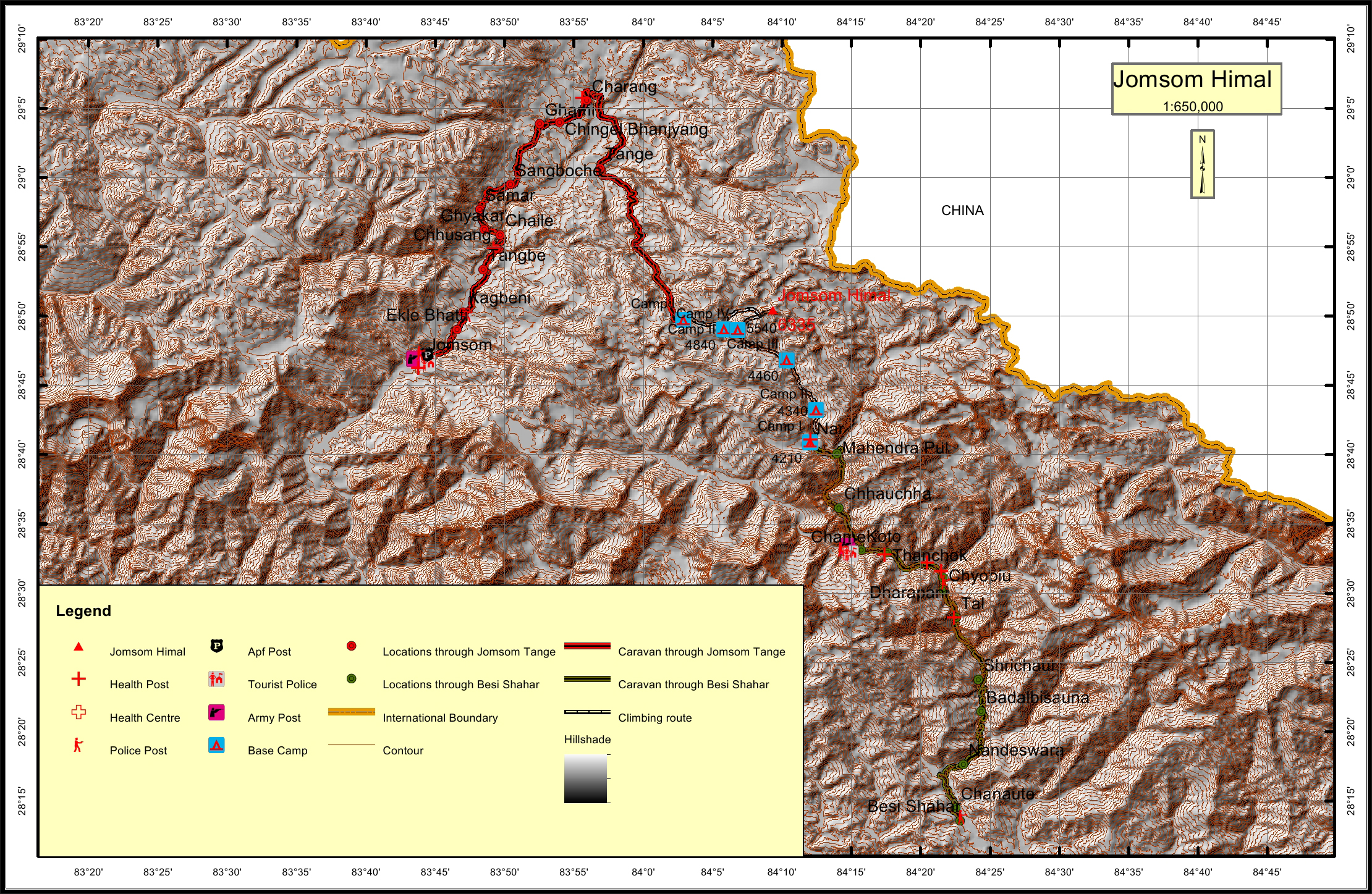
Jomsom Himal Overview

Other Name

Jonsong, Jomsang

Peak ID

JOMS

Status

Opened

Elevation

6581 M / 20784 FT

Latitude

28º 50' 27"

Longitude

84º 09' 21"

History

1st ascent on

04 Nov, 2003 A.D

1st ascent by

Hugues De Varax,
Yves Exbrayat,
Frederique Gaume,
Paulo Grobel,
Mingma Temba Sherpa,

Location

  • Province:

    Gandaki Pradesh
  • Mountain Range:

    Damodar
  • District:

    Manang
  • Municipality/Rural Municipality:

    Nar Phu

Nearest help center

( from the basecamp along
the caravan route )
  • Police post:

    Kagbeni 90.9KM Dharapani 34.1KM
  • Armed police post

    Jomsom 99.7KM
  • Army post:

    Jomsom 99.7KM
  • Health centre/post:

    Charang 46.2KM Nar
  • Tourist police post:

    Jomsom 99.7KM
  • Nearest settlement :

    Tange 29.1KM Nar

Royalty Fees

  • Nepalese (NRs):

    Spring 4000, Autumn 2000, Winter/Summer 1000
  • Foreigners (USD):

    Spring 250, Autumn 125, Winter/Summer 70

How to get there

  • From Kathmandu:

    Drive to Besisahar
  • Caravan route:

    Besisahar-Koto-Meta-Naar-Jomsomkhola-BC\ Jomsom-Kagbeni-Tangye-Kog-Teri la Pass-BC\ Jomsom-Kagbeni-Lomanthang-Damodarkunkda-BC
  • Caravan route
    length:

    99.7KM through Jomsom, 76.2KM through Besi Shahar
  • Climbing route
    length:

    13.3KM through Jomsom, 31KM through Besi Shahar
  • Duration:

    24 Days

Maps