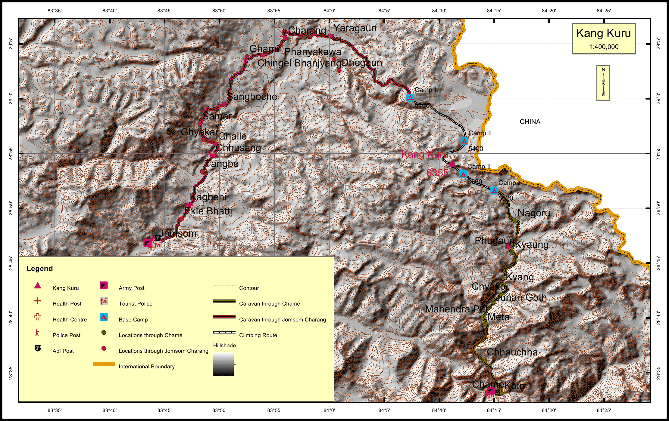
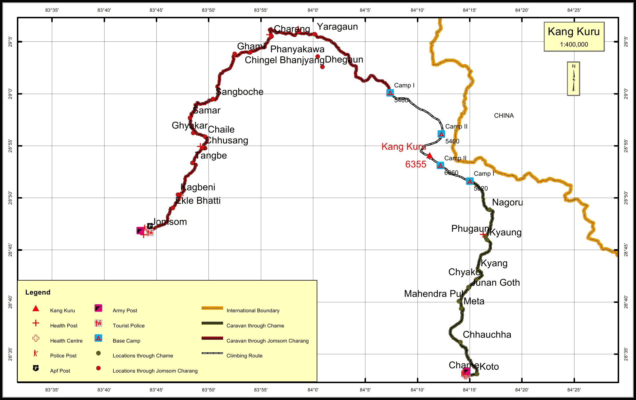
Kang Kuru Overview

Peak ID

KAKU

Status

Opened

Elevation

6355 M / 20850 FT

Latitude

28º 54' 05"

Longitude

84º 11' 10"

History

1st ascent on

16 Apr, 2008 A.D

1st ascent by

Peter Athans,
Theodore Hessler,

Location

  • Province:

    Gandaki Pradesh
  • Mountain Range:

    Damodar
  • District:

    Mustang/Manang
  • Municipality/Rural Municipality:

    Nar Phu/Dalome

Nearest help center

( from the basecamp along
the caravan route )
  • Police post:

    Kagbeni 90.2KM Chame 44.4KM
  • Armed police post

    Jomsom 99KM
  • Army post:

    Jomsom 99KM Chame 44.4KM
  • Health centre/post:

    Surkhang 38.4KM Phugaun 12.3KM
  • Tourist police post:

    Jomsom 99KM Chame 44.4KM
  • Nearest settlement :

    Yaragaun 34.2KM Nagoru 6.9KM

Royalty Fees

  • Nepalese (NRs):

    Sp 4000, Au 2000, Wi/Su 1000
  • Foreigners (USD):

    Sp 250, Au 125, Wi/Su 70

How to get there

  • From Kathmandu:

    By flight to Pokhara and Jomsom or by drive to Jomsom
  • Caravan route:

    Besisahar-Dharapani-Koto-Phu-BC
  • Caravan route
    length:

    99KM through Jomsom, 44.4KM through Chame
  • Climbing route
    length:

    2.9KM through Jomsom, 8KM through Chame
  • Duration:

    21 Days

Maps