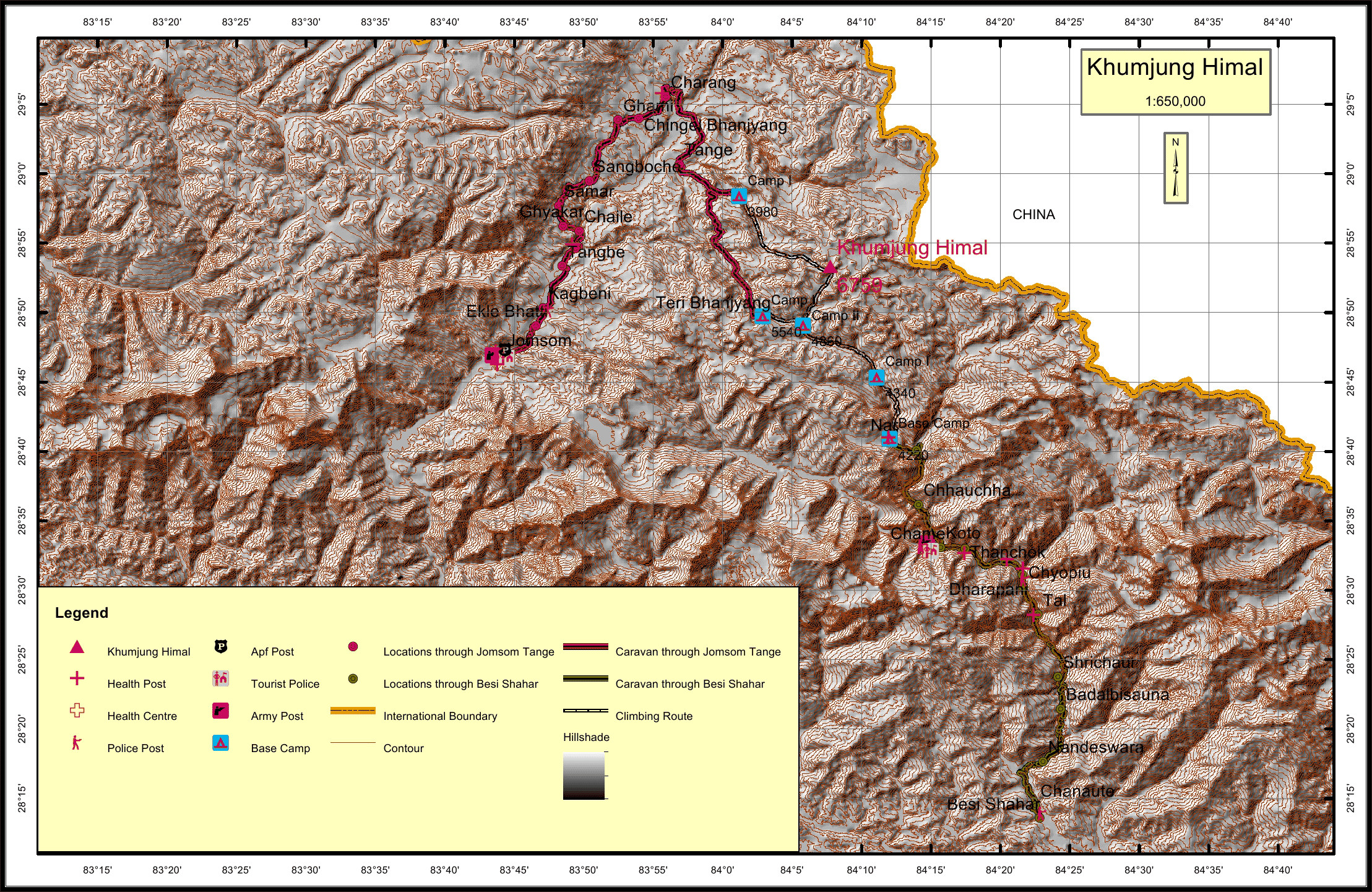
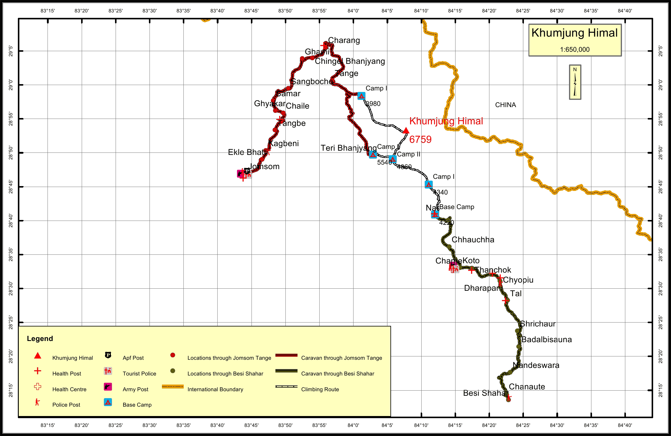
Khumjung Himal Overview

Peak ID

KMJG

Status

Opened

Elevation

6699 M / 22175 FT

Latitude

28º 53' 20"

Longitude

84º 07' 45"

Location

  • Province:

    Gandaki Pradesh
  • Mountain Range:

    Damodar
  • District:

    Mustang/Manang
  • Municipality/Rural Municipality:

    Nar Phu/Dalome

Nearest help center

( from the basecamp along
the caravan route )
  • Police post:

    Kagbeni 90.3KM Kagbeni 70.8KM Dharapani 34.2KM
  • Armed police post

    Jomsom 99KM through Teri Bhanjyang, Jomsom 79.5KM through Tange Khola
  • Army post:

    Jomsom 99KM
  • Health centre/post:

    Charang 45.5KM Charang 26KM Nar
  • Tourist police post:

    Jomsom 99KM
  • Nearest settlement :

    Tange 29.1KM Tange 9.6KM Nar

Royalty Fees

  • Nepalese (NRs):

    Sp 5000, Au 2500, Wi/Su 1250
  • Foreigners (USD):

    Sp 400, Au 200, Wi/Su 100

How to get there

  • From Kathmandu:

    By flight to Pokhara and Jomsom or by drive to Jomsom
  • Caravan route:

    Jomsom-Tange-Dhey-BC\Jomsom-Lomanthang-Damodar Kunda-BC
  • Caravan route
    length:

    99KM through Teri Bhanjyang, 79.5KM through Tange Khola, 76.2KM through Besi Shahar
  • Climbing route
    length:

    20.6KM through Teri Bhanjyang, 16.7KM through Tange Khola, 38.3KM through Besi Shahar
  • Duration:

    30 Days

Maps