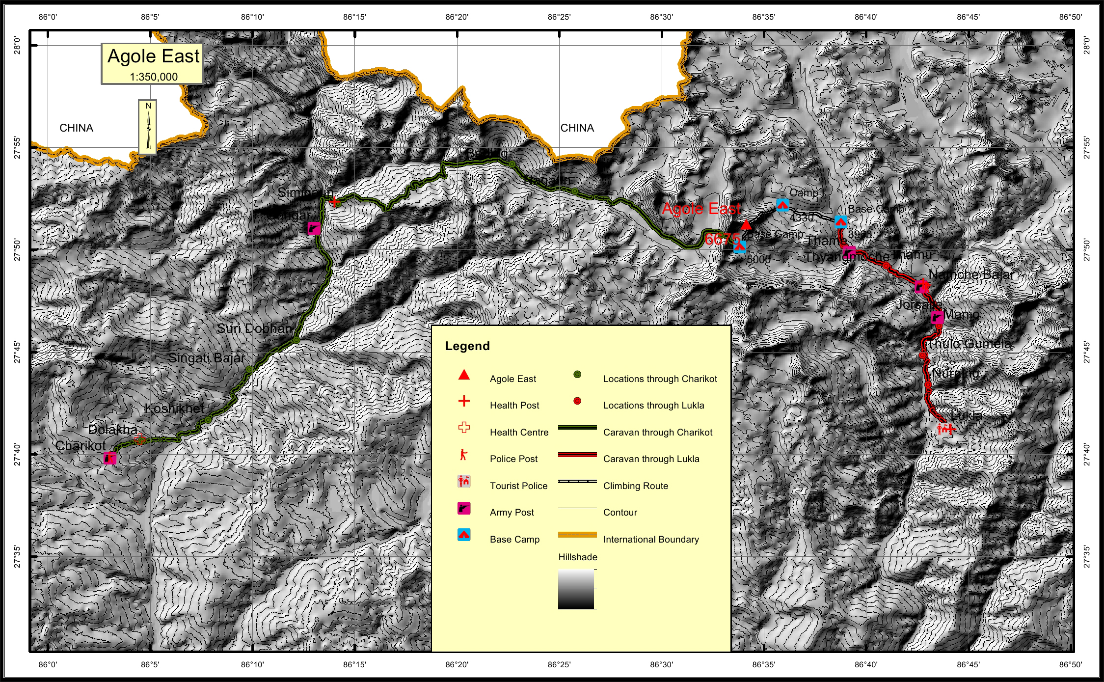
Agole East Overview

Peak ID

AGLE

Status

Opened

Elevation

6675 M / 21899 FT

Latitude

27°51'17

Longitude

86°34'08

Location

  • Province:

    Province 1
  • Mountain Range:

    Rolwaling
  • District:

    Solukhumbu
  • Municipality/Rural Municipality:

    Khumbu Pasang Lhamu

Nearest help center

( from the basecamp along
the caravan route )
  • Police post:

    Charikot 79.9KM Namche 10.5KM
  • Army post:

    17KM Thyangmoche 2.2KM
  • Health centre/post:

    Namche 10.5KM Simigaun 42.7KM
  • Tourist police post:

    Lukla 30.2KM
  • Nearest settlement :

    17KM Thyangmoche 2.2KM

Royalty Fees

  • Nepalese (NRs):

    Spring 5000, Autumn 2500, Wi/Summer 1250
  • Foreigners (USD):

    Spring 400, Autumn 200, Wi/Summer 100

How to get there

  • From Kathmandu:

    By flight to Lukla
  • Caravan route:

    Lukla-Namche-Thame-TargnaChudonmo khola-BC/Charikot-Simigaun-Beding-Na-Tolumbau glacier BC.
  • Caravan route
    length:

    79.9KM through Charikot, 30.2KM through Lukla
  • Climbing route
    length:

    2.3KM through Charikot, 8.7KM through Lukla
  • Duration:

    21 Days

Maps

Four Faces

Agole East (East Face)

Agole East (South Face from Pachhermo)