Ama Dablam Overview
Other Name
Amai Dablang
Peak ID
AMAD
Status
Opened
Elevation
6814 M / 22365 FT
Latitude
27º 51' 40
Longitude
27º 51' 40
History
1st ascent on
March 13,1961
1st ascent by
Mike Gill,
Wally Romanes,
Barry Bishop,
Michael Ward,
Wally Romanes,
Barry Bishop,
Michael Ward,
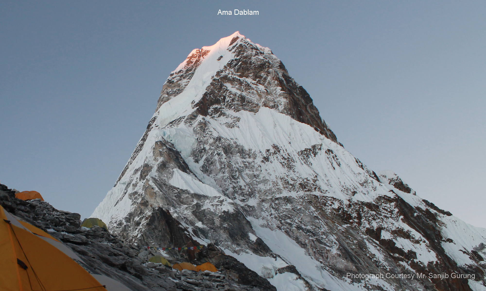
Ama Dablam, also known as Amai Dablang, popularly known as “Matterhorn of the Himalay”, is one of the well-known peaks in the Himalaya range. It is the third most popular Himalayan peak permitted for expedition. It belongs to the Mahalangur sub range of the Nepalese Himalayas. The name Ama Dablam mean “Mother’s necklace”. The long ridges on its either side are considered the arms of mother (ama) wich are protecting her child and the hanging glaciers are considered the dablam, which mean a traditional double pendant with the god’s picture imprinted on it, much worn by the Sherpa women in Nepal.
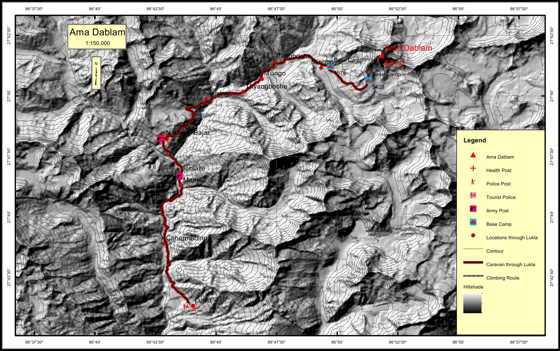
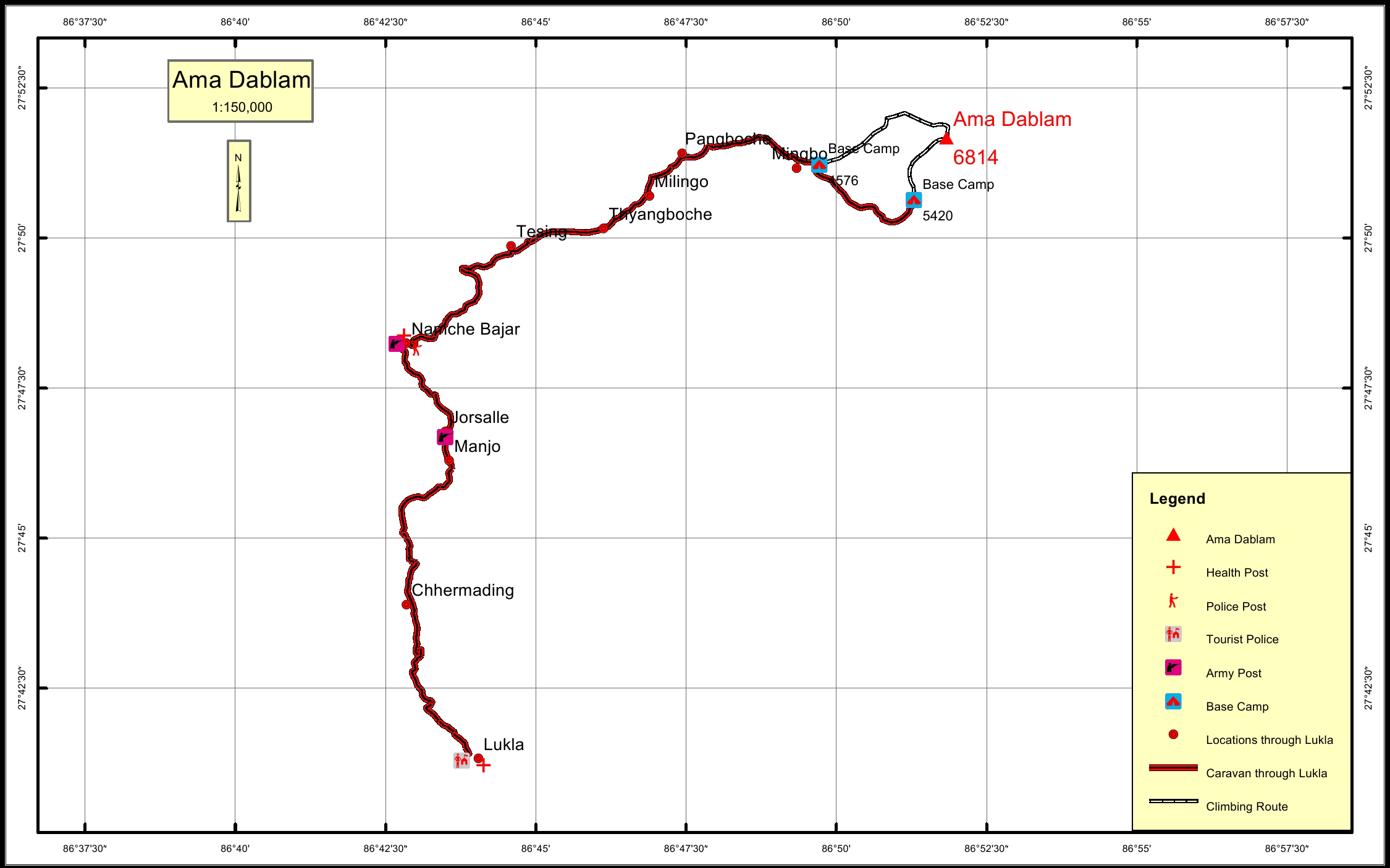
Location
Nearest help center
( from the basecamp alongthe caravan route )
Royalty Fees
How to get there
Maps
Four Faces
_img_6634.jpg)
Ama Dablam (North East Face (Island Peak)