Barun Tse Overview

Peak ID

BARU

Status

Opened

Elevation

7129 M / 23464 FT

Latitude

27º 52' 17

Longitude

86º 58' 58

History

1st ascent on

May 29,1954

1st ascent by

Colin Todd,
Geoff Harrow,

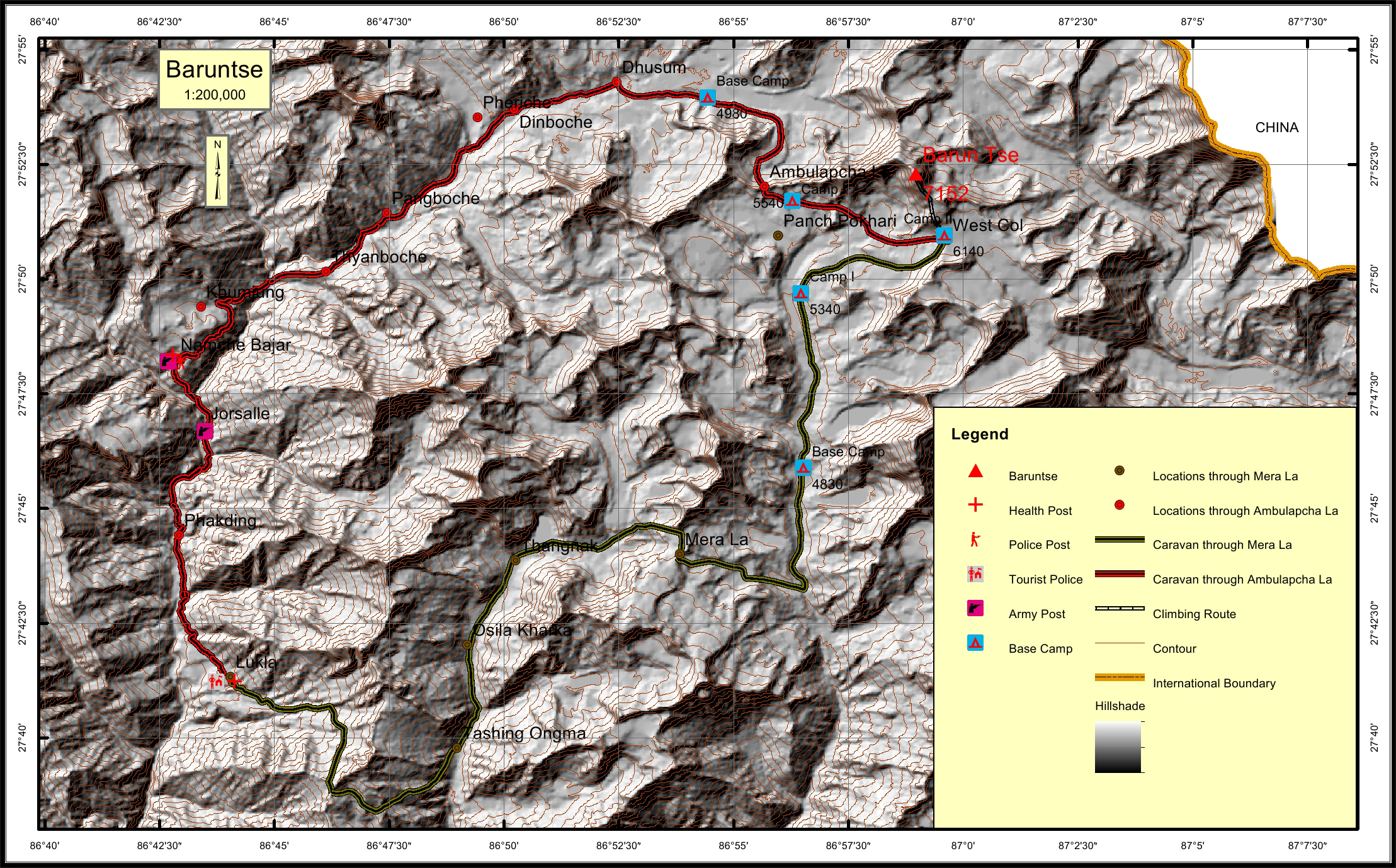
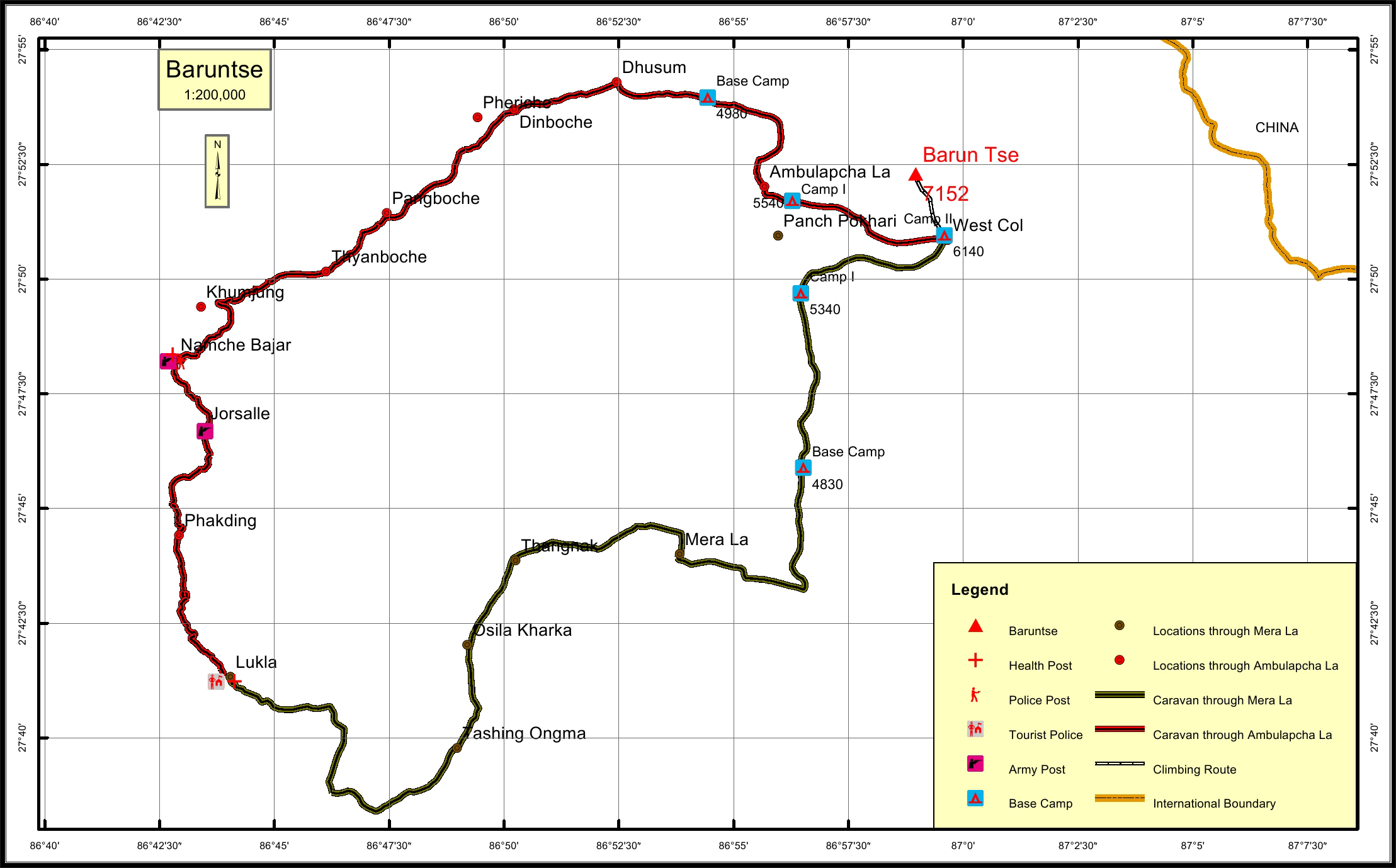
Barun Tse is a mountain located in Mahalangur ridge in the Khumbu region of eastern Nepal, crowned by four peaks and bounded on the south by Hunku Glacier, on the east by Barun Glacier, and on the northwest by Imja glacier. Barun Tse peak 7152 meters is located jus south of the semi- circle of fantastic mountains comprising Everest, Lhotse and Nuptse and Makalu on the other side. The expedition to Barun Tse peak approaches base camp through the pristine wilderness environment of the Hinku valley and the renowned Mera La of Makalu Barun remote valleys of Nepal. Accessing the mountain is usually gained from the south, where climbers can ascend Mera Peak to acclimatize before moving up the valley to Barun Tse base camp. The route of south-east ridge of Barun Tse is filled with hard sections of 50 degrees elevation with a prominent ice cliff to be climbed facing the risk of avalanche that is why it is the difficult way. Base camp of Barun Tse is located nearby Panchpokhari(5200m)

Location

  • Province:

    Province 1
  • Mountain Range:

    Barun
  • District:

    Solukhumbu/Sankhuwasabha
  • Municipality/Rural Municipality:

    Makalu/Mahakulung

Nearest help center

( from the basecamp along
the caravan route )
  • Police post:

    Namche 39.1KM
  • Army post:

    Namche 39.1KM
  • Health centre/post:

    Namche 39.1KM
  • Tourist police post:

    LukLa 55.7KM Lukla 54KM
  • Nearest settlement :

    Dhusum 16.9KM Lukla 54KM

Royalty Fees

  • Nepalese (NRs):

    Rs.6000/- in Spring, Rs.3000/- in Autumn and Rs.1500/- in Winter and Summer
  • Foreigners (USD):

    125.00 in Summer and Winter, $250.00 in Autumn and $500.00 in Spring

How to get there

  • From Kathmandu:

    Flight to Lukla
  • Caravan route:

    Lukla-Thaknag-Merala-Panch Pokhari-BC/Tumlingtar-Tashgaun-BC.
  • Caravan route
    length:

    55.7KM through Ambulapcha La, 54KM through Mera La
  • Climbing route
    length:

    2.7KM
  • Duration:

    35 Days

Maps

Four Faces

Baruntse (West Face from Island Peak)

Baruntse (east face from Swiss BC)

Baruntse (South face from Barunttse Camp I)