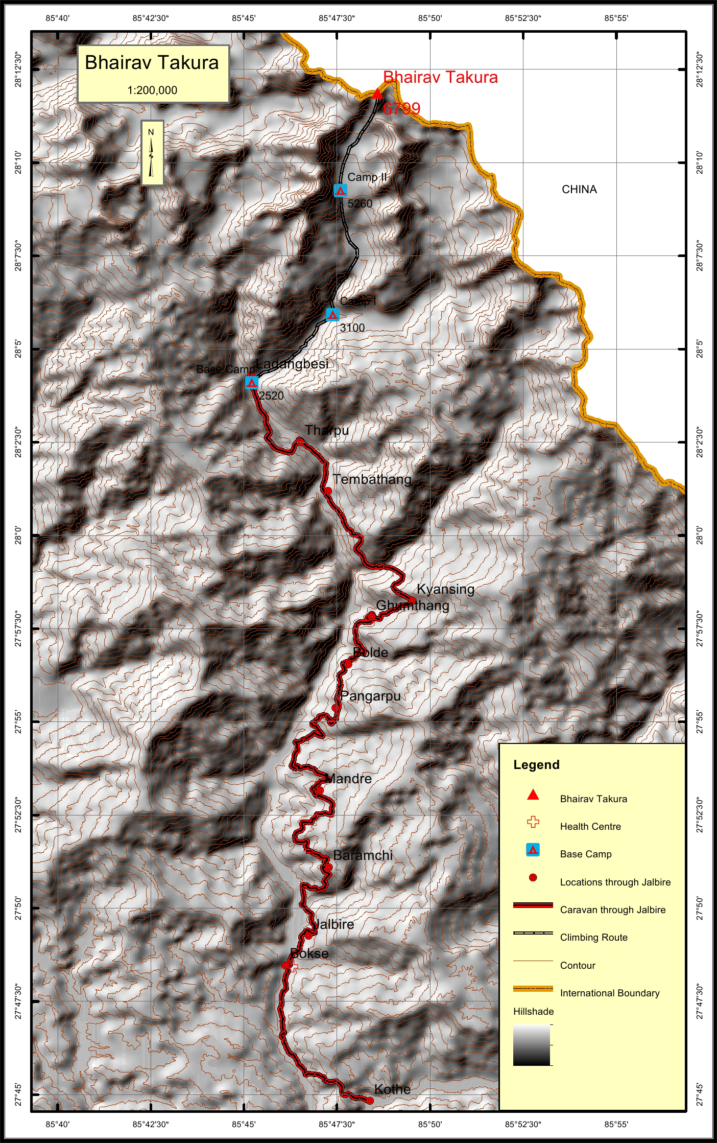
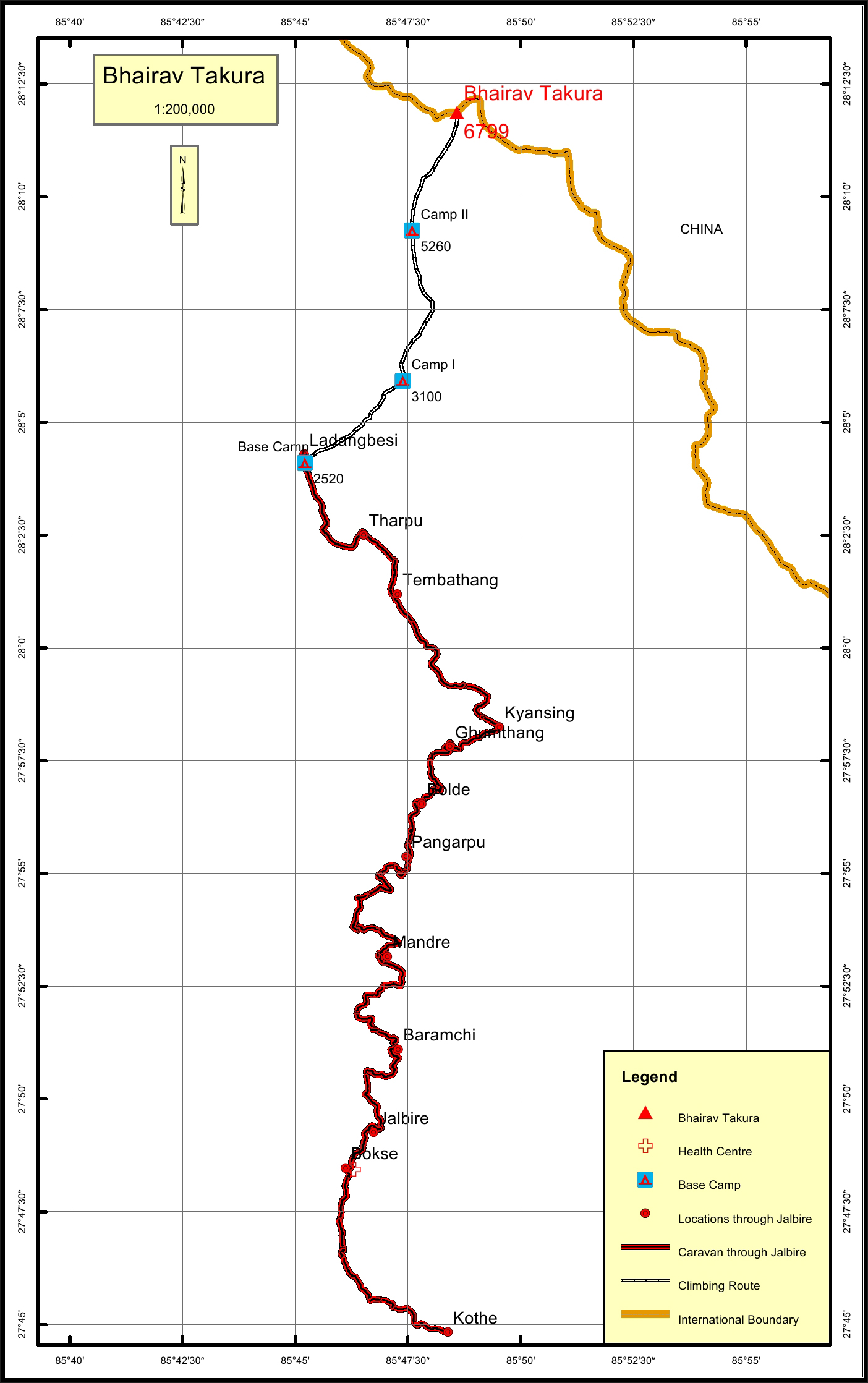
Bhairab Takura Overview

Other Name

Madiya

Peak ID

BTAK

Status

Opened

Elevation

6799 M / 22306 FT

Latitude

28º 11' 52"

Longitude

85º 48'35"

History

1st ascent on

May 7,1960

1st ascent by

Kunitoshi Ishihara,
Yukihito,
Pasang Phutar Sherpa,

Bhairav Takura is on the boundary of Nepal and China, has an elevation of 6799m. Bhairav Takura lies in Jugal Mountain Range. Bhairav Takura is 890 meters east of Leonpo Gang, the highest peak of Jugal Mountain Range and 1040 meters South west of Leonpo Gang East.

Location

  • Province:

    Bagmati Pradesh
  • Mountain Range:

    Jugal
  • District:

    Sindhupalchok/NC
  • Municipality/Rural Municipality:

    Jugal/NC

Nearest help center

( from the basecamp along
the caravan route )
  • Health centre/post:

    Bokse at 0.1KM
  • Nearest settlement :

    Tharpu at 0KM

Royalty Fees

  • Nepalese (NRs):

    NRs 5000 in spring season, NRs 2500 in autumn and NRs 1250 in winter and summer for expedition
  • Foreigners (USD):

    USD 400 in spring season, USD 200 in autumn season and USD 100 in winter and summer for expedition

How to get there

  • From Kathmandu:

    Drive to Kothe (Arniko Highway)
  • Caravan route:

    Barabishe-Listimai-Bagan-Bhairav Kunda-BC
  • Caravan route
    length:

    0.1KM
  • Climbing route
    length:

    0KM
  • Duration:

    30 Days

Maps