Home
About
About Peak Profile
NHPP Committee
Our Staffs
Peak Profile
All Peaks
5800m - 6499m Peaks
6500m - 6999m Peaks
7000m - 7499m Peaks
7500m - 7999m Peaks
Above 8000m Peaks
Contact
Home
About
About Peak Profile
NHPP Committee
Our Staffs
Peak Profile
All Peaks
5800m - 6499m Peaks
6500m - 6999m Peaks
7000m - 7499m Peaks
7500m - 7999m Peaks
Above 8000m Peaks
Contact
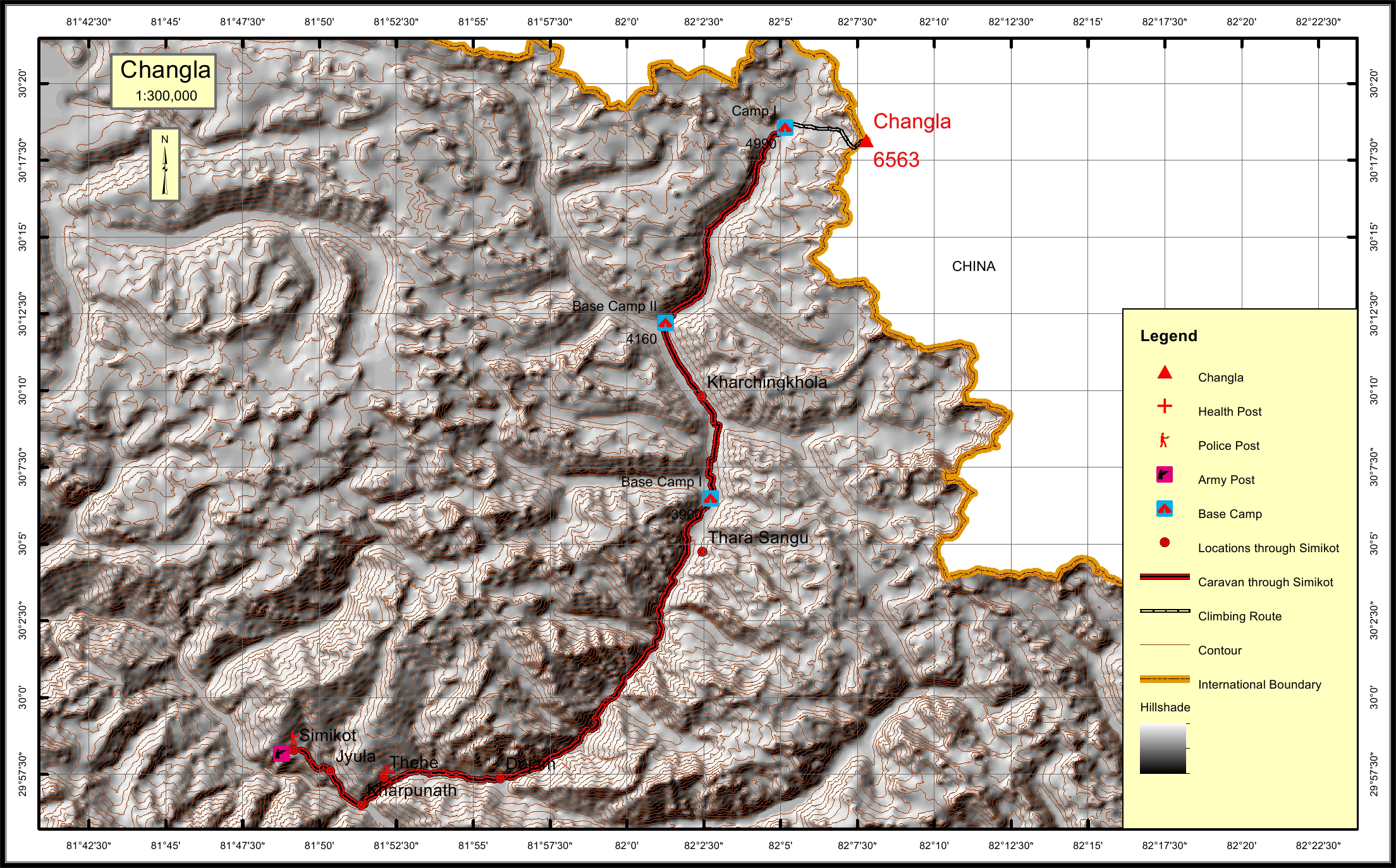
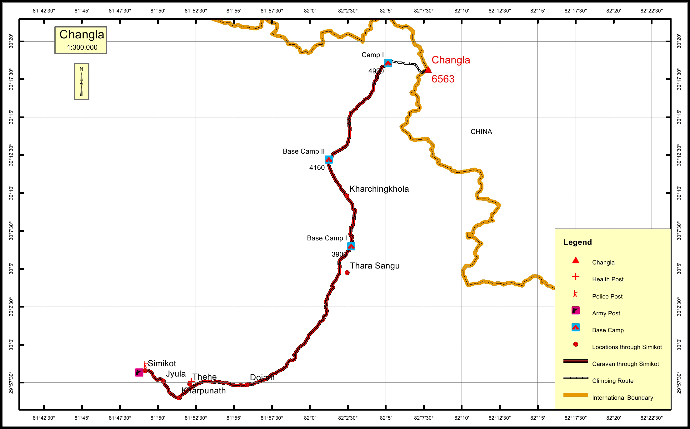
Changla Khang Overview
Peak ID
CHKH
Status
Proposed to open
Elevation
6581 M / 21591 FT
Latitude
30.153765309
Longitude
82.20740
Location
Province:
Karnali Pradesh
Mountain Range:
Changla
District:
Humla/NC
Municipality/Rural Municipality:
Kharpunath/NC
Nearest help center
( from the basecamp along
the caravan route )
Police post:
Simikot 41.2KM
Army post:
Simikot 41.2KM
Health centre/post:
Thehe 33.8KM
Nearest settlement :
Dojam 27.2KM
Royalty Fees
Nepalese (NRs):
Spring 5000, Autumn 2500, Winter/Summer 1250
Foreigners (USD):
Spring 400, Autumn 200, Winter/Summer 100
How to get there
From Kathmandu:
By flight to Nepalganj and Simikot
Caravan route:
Simikot-Kharpunath-Thehe-Dojam-Thara Sangu-BC
Caravan route
length:
41.2KM through Simikot
Climbing route
length:
16.6KM
Duration:
45 Days
Maps
Nepal Himal Peak Profile
Discover the information about mountains in Nepal.
Select All
Province
District
Municipality/Rural Municipality
Himalayan Range
Select All
Secriteriate And Technical Support:
© Copyright Nepal Government. All rights reserved.
Website by
Curves n'Colors