Chulu East * Overview
Other Name
Chulu Central
Peak ID
CHUE
Status
Opened
Elevation
6584 M / 21601 FT
Latitude
84º 02' 12"
Longitude
84.0367
Managed By
NMA
History
1st ascent on
Jul 23,1955
1st ascent by
Heinz Steinmetz,
Harald Biller,
Fritz Lobbichler,
Juergen Wellenkamp,
Harald Biller,
Fritz Lobbichler,
Juergen Wellenkamp,
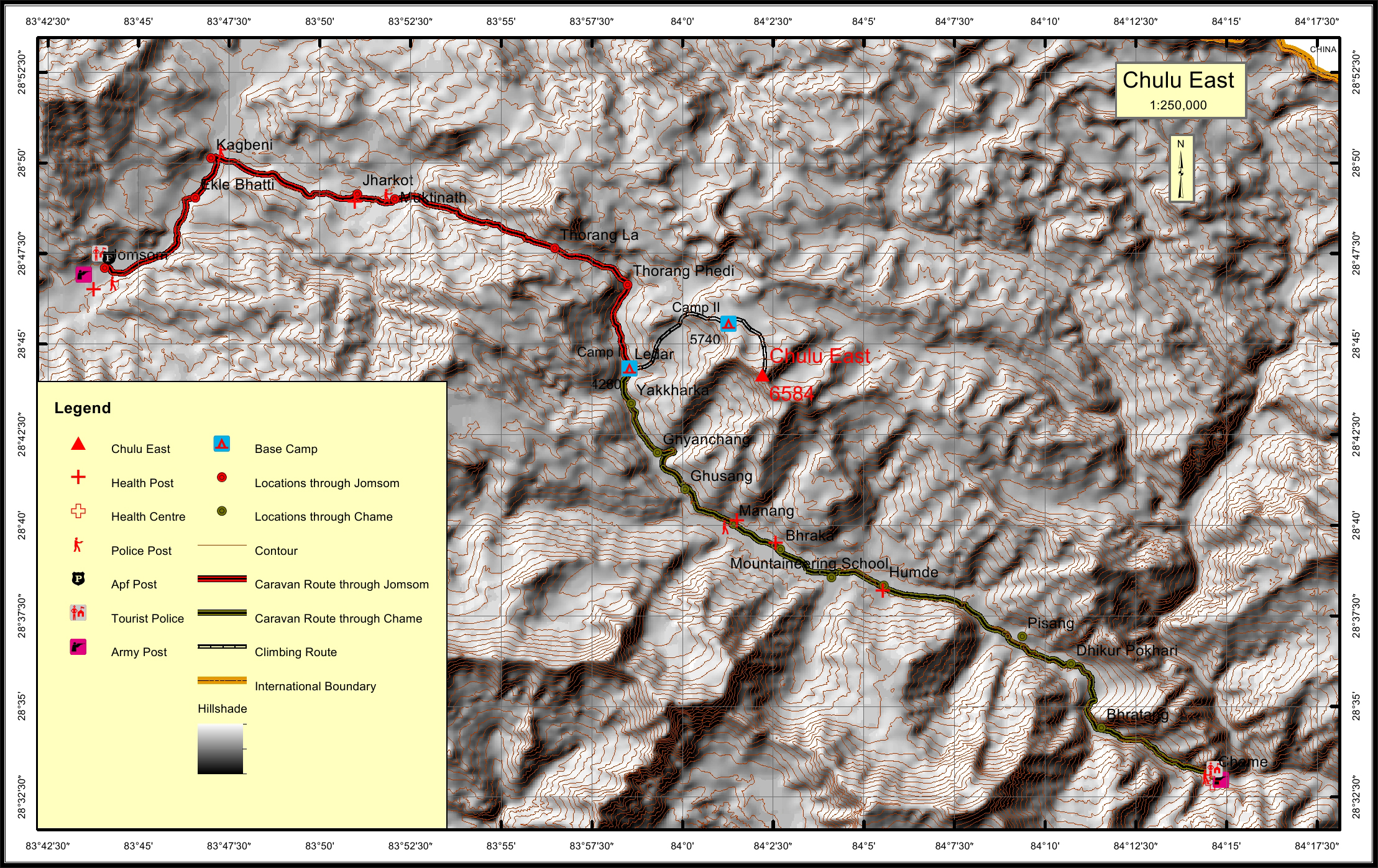
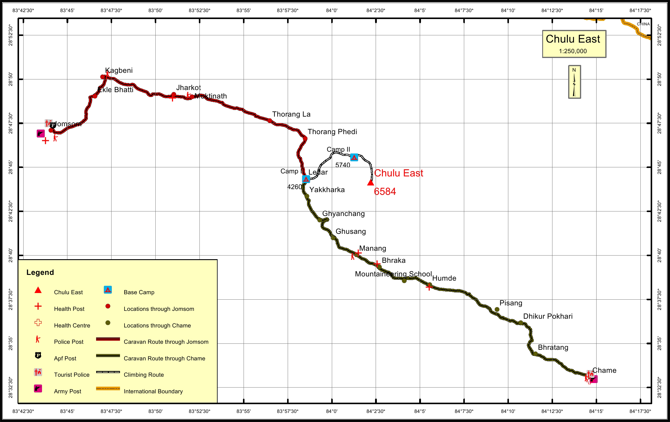
The climb of Chulu East is often combined with the classic Annapurna Circuit
Trek. The approach to base camp is from the village of Manang. The common
route to the summit is via the North-East Ridge which was climbed in 1955
by a German expedition.
Chulu East is situated high above the Manang valley with breathtaking
views across to the Annapurnas II, III and IV, Gangapurna, Glacier Dome,
Dhaulagiri, Tilicho Peak and Manaslu.
Chulu East requires previous alpine experience with crossings of fractured
glacial terrain and steep scree slopes to gain the main high summit ridge.
There is a second peak on the Chulu East permit called Chulu Far East
(6,060 m) which guide Jamie McGuinness states “should be the ‘Island Peak’ of the Annapurnas, straightforward yet fun.” Both peaks share the same base
camp. Note that groups often climb Chulu Far East instead of Chulu East.
Beyond the common ridge route, there is also a route that climbs the East
Ridge (AD+) which requires a high camp, and a route that ascends the South
East Ridge (D). Both require different base camps.
Location
Nearest help center
( from the basecamp alongthe caravan route )
Royalty Fees
How to get there
Maps