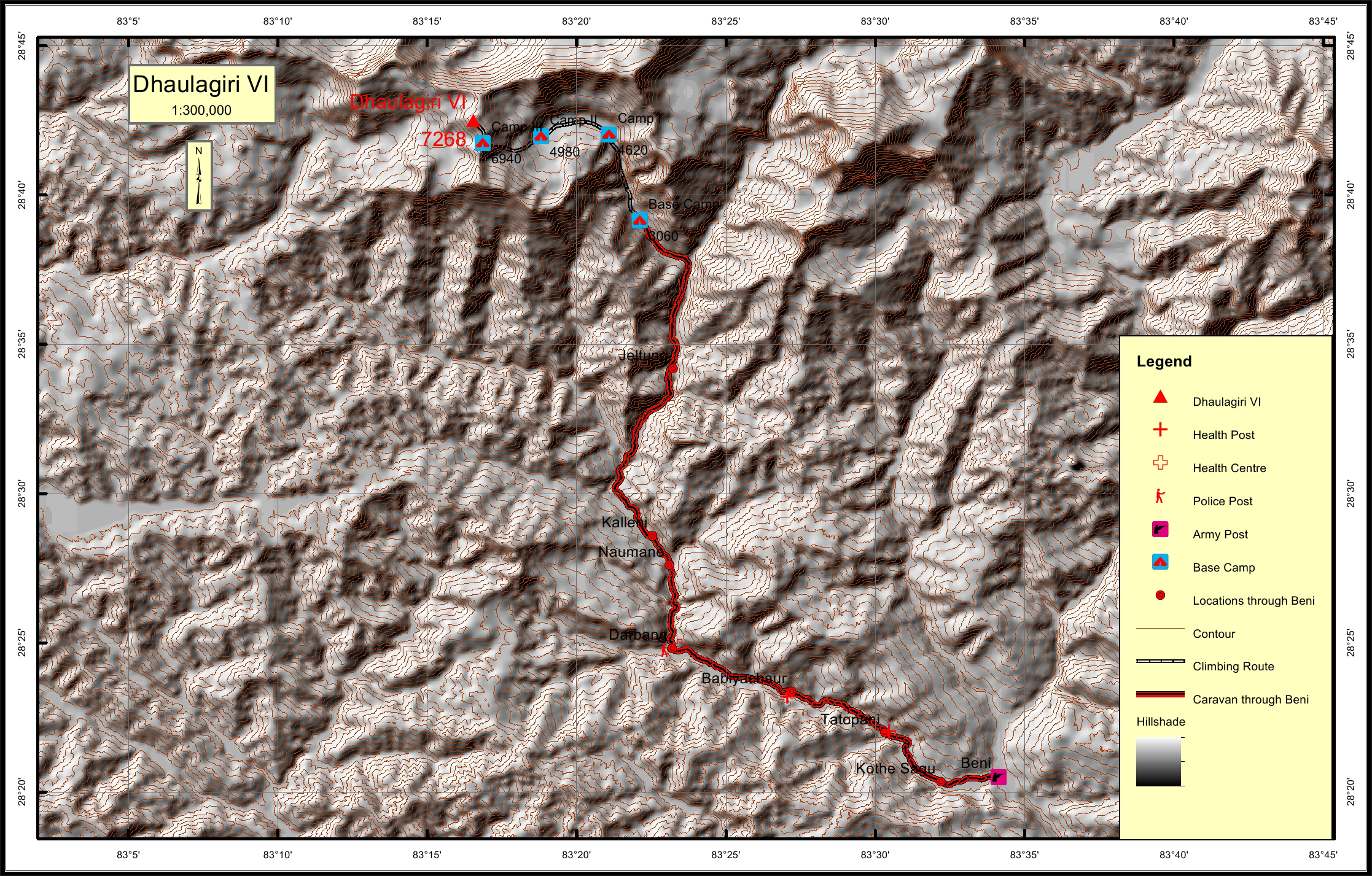
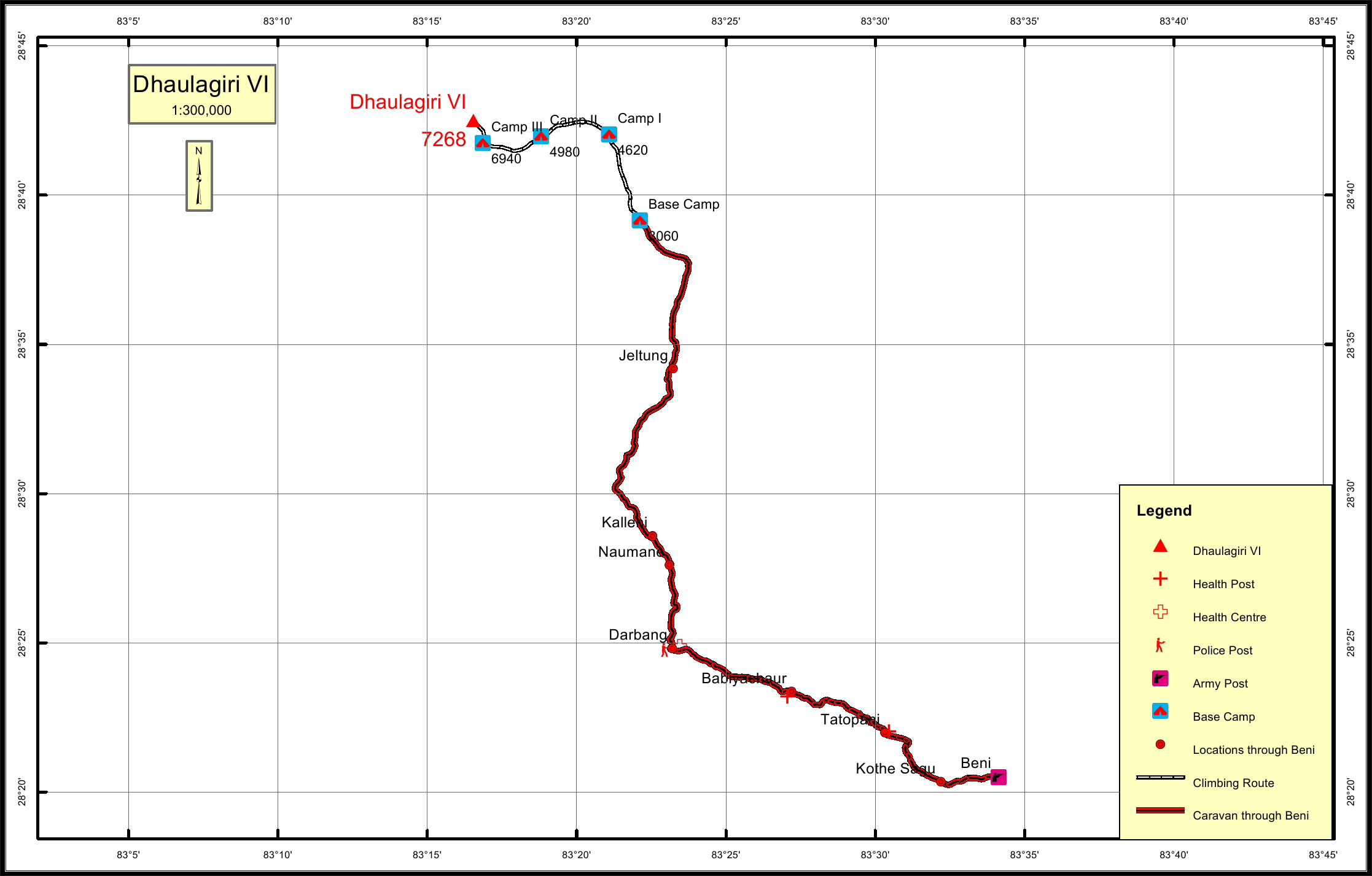
Dhaulagiri VI Overview
Peak ID
DHA6
Status
Opened
Elevation
7268 M / 23845 FT
Latitude
28º 42' 30
Longitude
83º 16' 33
History
1st ascent on
Apr 17,1970
1st ascent by
Shiro Kawazu,
Shoichi Kimura,
Hisazumi Nakamura,
Seijiro Yamamura,
Shoichi Kimura,
Hisazumi Nakamura,
Seijiro Yamamura,
The Dhaulagiri massif extends 120kms. (70 miles) west from the Kali Gandaki river to the Bheri river. The massif is bounded on the north and south west by tributaries of tributaries of Bheri river and on the southeast by Myagdi river.
The mountain’s name is ‘in Dhaulagiri’ in Nepali. This comes from ‘sanskrit’ where ‘Dhawala’ means dazzling white, beautiful and ‘Giri’ means mountain. Dhaulagiri’s sudden rise from the Kali Gandaki almost unequaled. It rises 7000m. (22970ft.) from the Kali Gandaki river 30km. to the south east. Dhaulagiri VI and Gurja himal are on a ridge extending south from Junction peak. Its best views generally hidden by Gurja himal.
Location
Nearest help center
( from the basecamp alongthe caravan route )
Royalty Fees
How to get there
Maps