Gangapurna Overview

Peak ID

GANM

Status

Opened

Elevation

7455 M / 24458 FT

Latitude

28º 36' 19"

Longitude

83º 57' 57"

History

1st ascent on

May 06,1965

1st ascent by

Gunter Hauser,
Ludwig Greissl,
Hermann Kollensperger,
Erich Reismueller,
Ang Temba Sherpa,
Phu Dorje Sherpa,

Mountain Description

Mt. Gangapurna is one of the famous, beautiful and excellent mountains in Nepal. It is located to the northeast of Mt. Annapurna at the opposite end of Grand Barrier to Tilicho peak on the shoulder extending 10 kilometers from Annapurna directly east of Roc Noir. It lies between Annapurna III and Tilicho peak.

Gangapurna can be seen from the foothills of the Annapurna range as far as to Pokhara. Gangapurna peak rise high above the Manang valley with breathtaking views across to the Annapurna II, III and IV, Glacier Dome, Dhaulagiri, Tilicho peak and Manaslu and then ascending high above Marshyangdi valley.

Location

  • Province:

    Gandaki Pradesh
  • Mountain Range:

    Annapurna
  • District:

    Kaski/Manang
  • Municipality/Rural Municipality:

    Nesyang/Annapurna

Nearest help center

( from the basecamp along
the caravan route )
  • Police post:

    Ghandruk at a distance of 0KM at and at Manang approximately at a distance of 0KM
  • Army post:

    Chame the district headquarter of Manang district at a distance of 0KM approximately.
  • Health centre/post:

    Ghandruk at a distance of 0KM away at and at Manang at a distance of 0KM approximately.
  • Tourist police post:

    Ghandruk 23.5KM 28KM
  • Nearest settlement :

    Himalaya at a distance of 0KM kms. and Manang at a distance of 0KM kms. approximately.

Royalty Fees

  • Nepalese (NRs):

    Rs. 6000.00 during spring, Rs. 3000.00 for autumn and Rs. 1500.00 during winter/summer seasons
  • Foreigners (USD):

    US$ 500.00 for spring, US$ 250.00 in autumn and US$ 125.00 during winter/summer seasons.

How to get there

  • From Kathmandu:

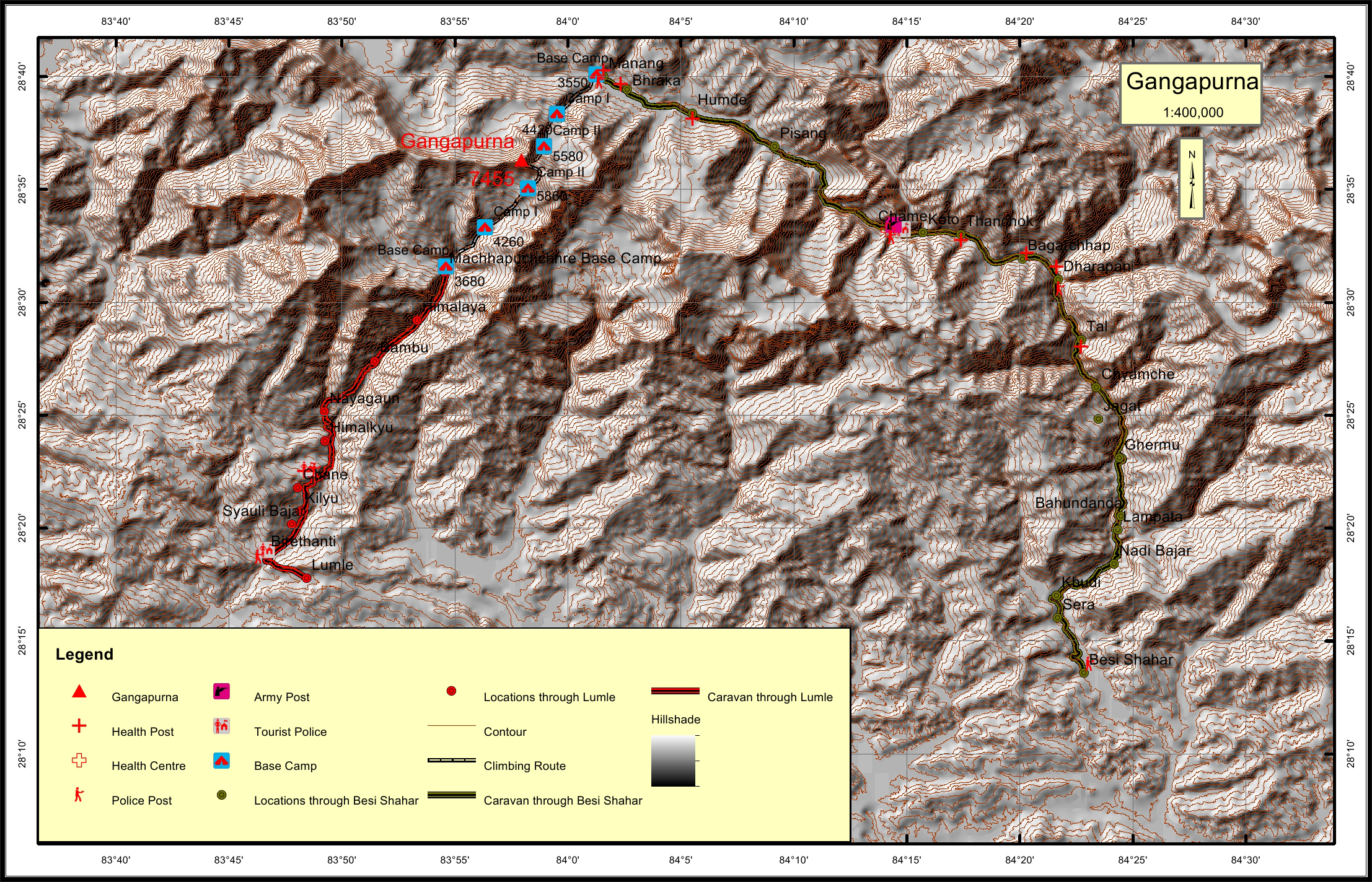
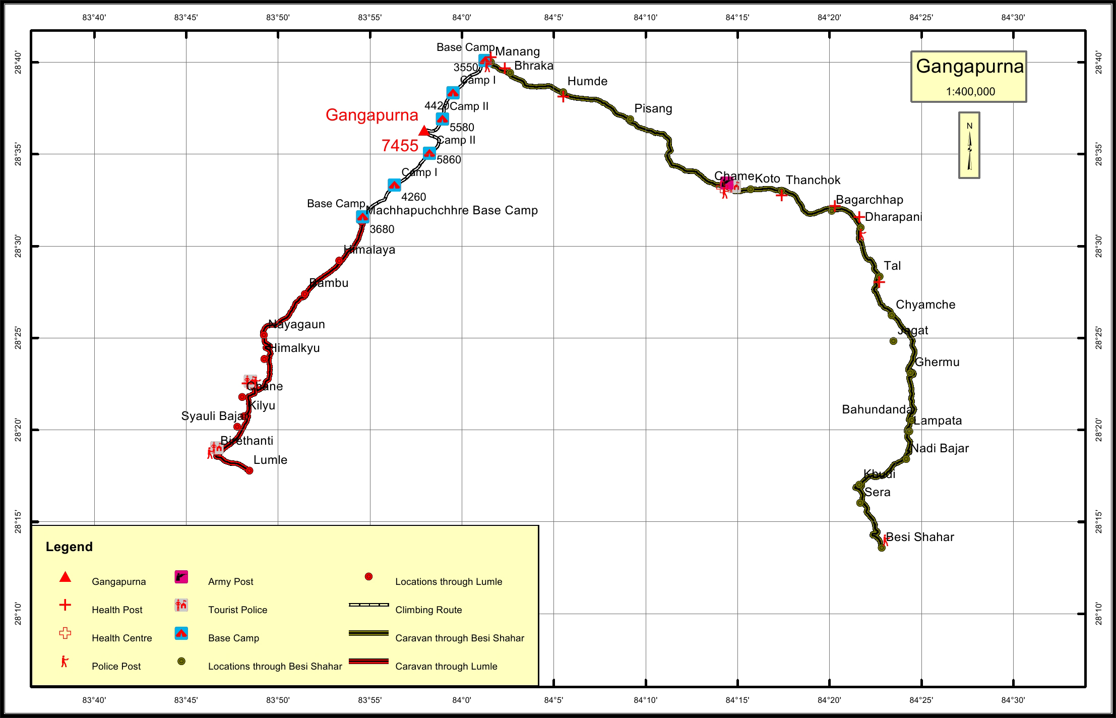
    There are two approaches to this mountain peak. One from Besi Shahar and the other from Lumle. To reach Besi Shahar, the district headquarter of Lamjung, one can fly to Pokhara and take a vehicle to Besi Shahar or take a vehicle to Chame directly from Kathmandu. The second approach is by flight to Pokhara and then by vehicle to Lumle or by vehicle from Kathmandu to Lumle.
  • Caravan route:

    Besisahar-Chame-Manang-BC
  • Caravan route
    length:

    83.9KM through Besi Shahar and 35.5KM through Birethanti
  • Climbing route
    length:

    12.2KM through Birethanti and 9.3KM through Besi Shahar
  • Duration:

    45 Days

Maps