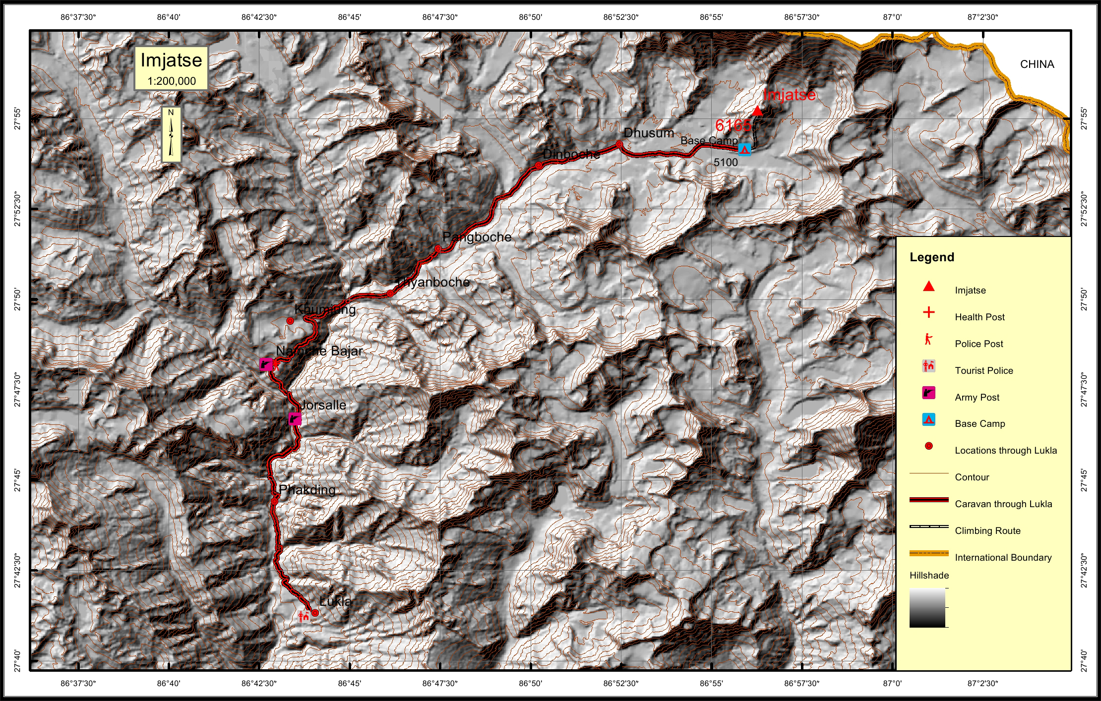
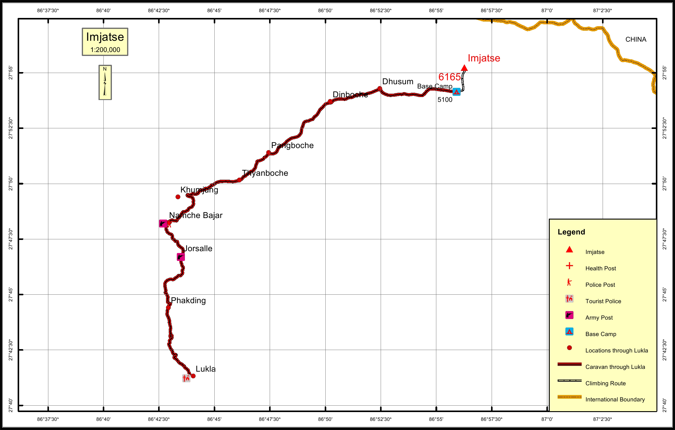
Imja Tse * Overview
Other Name
Island Peak
Peak ID
IMJA
Status
Opened
Elevation
6165 M / 20226 FT
Latitude
27º 55' 14"
Longitude
86º 56' 16"
Managed By
NMA
History
1st ascent on
1956 A.D
1st ascent by
Hansrudolf Von Gunten,
2 unknown Sherpas,
2 unknown Sherpas,
Imja Tse, also known as the Island Peak, is located in the Sagarmatha National Park of the Himalayas in the Eastern Development Regions of Nepal. The name Island Peak was named in 1953 by members of British Mount Everest expedition as it appeared like an island in the sea of ice when viewed from Dingboche. The peak was renamed Imja Tse in 1983, however, the initial name “Island Peak” has remained popular among the summiteers.
Location
Nearest help center
( from the basecamp alongthe caravan route )
Royalty Fees
How to get there
Maps