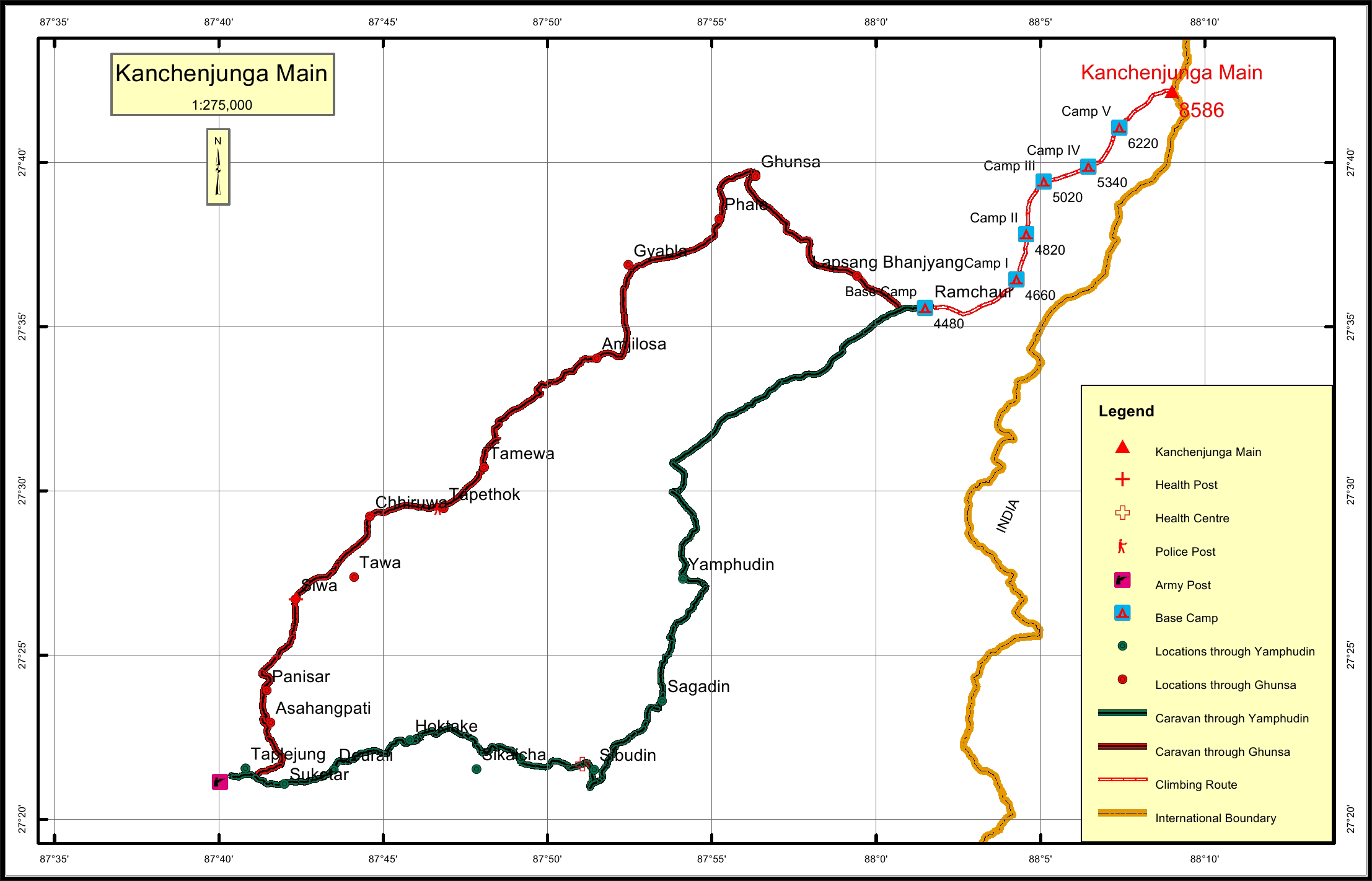
Kanchenjunga Main Overview
History
Mount Kanchenjunga Main is the third highest mountain peak in the world. It
has an elevation of 8,586 m (28,169 ft) in a section of the Himalayas called the
Kangchenjunga mountain range delimited in the west by the Tamur River , in
the north by Jongsang La and Nepal-China border. Kanchenjunga Main is on
the border of Phaktanglung and Sirijanga rural municipality in Taplejung
district and India. Kanchenjunga Main is 1.1 km east southeast from Yalung
Khang and 0.8 km north northwest from Kanchenjunga Central.
Until 1852, Kangchenjunga was assumed to be the highest mountain in the
world, but calculations based on various readings and measurements made by
the Great Trigonometrical Survey of India in 1849 came to the conclusion that
Mount Everest, known as Peak XV at that time, was the highest. Allowing for
further verification of all calculations, it was officially announced in 1856 that
Kangchenjunga was the third highest mountain in the world.
Kangchenjunga was first successfully climbed on 25 May, 1955 by Joe Brown
and George Band, who were part of a British expedition . They stopped short of
the summit in accordance with the promise given to the Chogyal that the top of
the mountain would remain intact. Every climber or climbing group that has
reached the summit has followed this tradition.
Location
Nearest help center
( from the basecamp alongthe caravan route )


.jpg)
.jpg)
.jpg)


