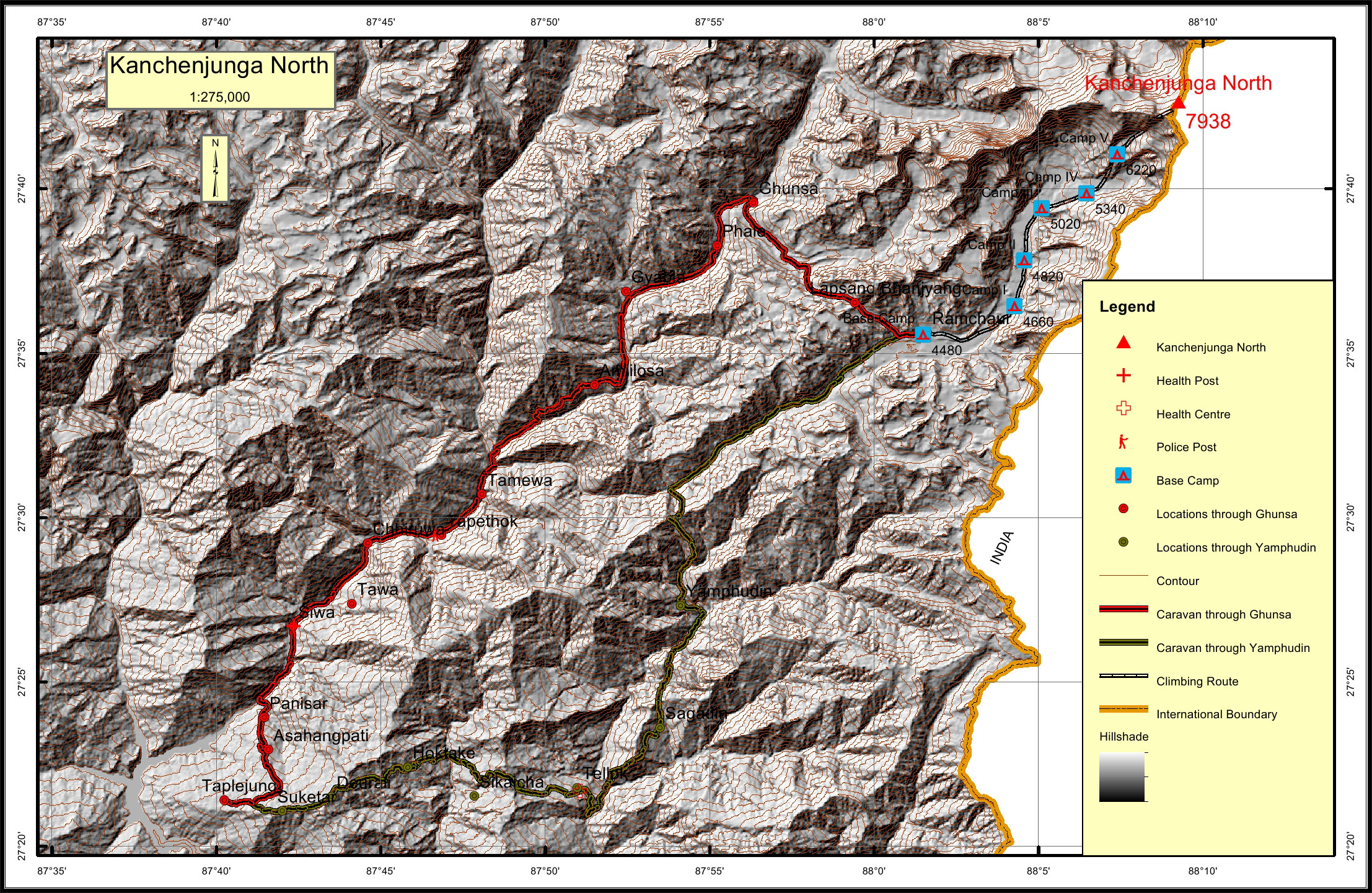
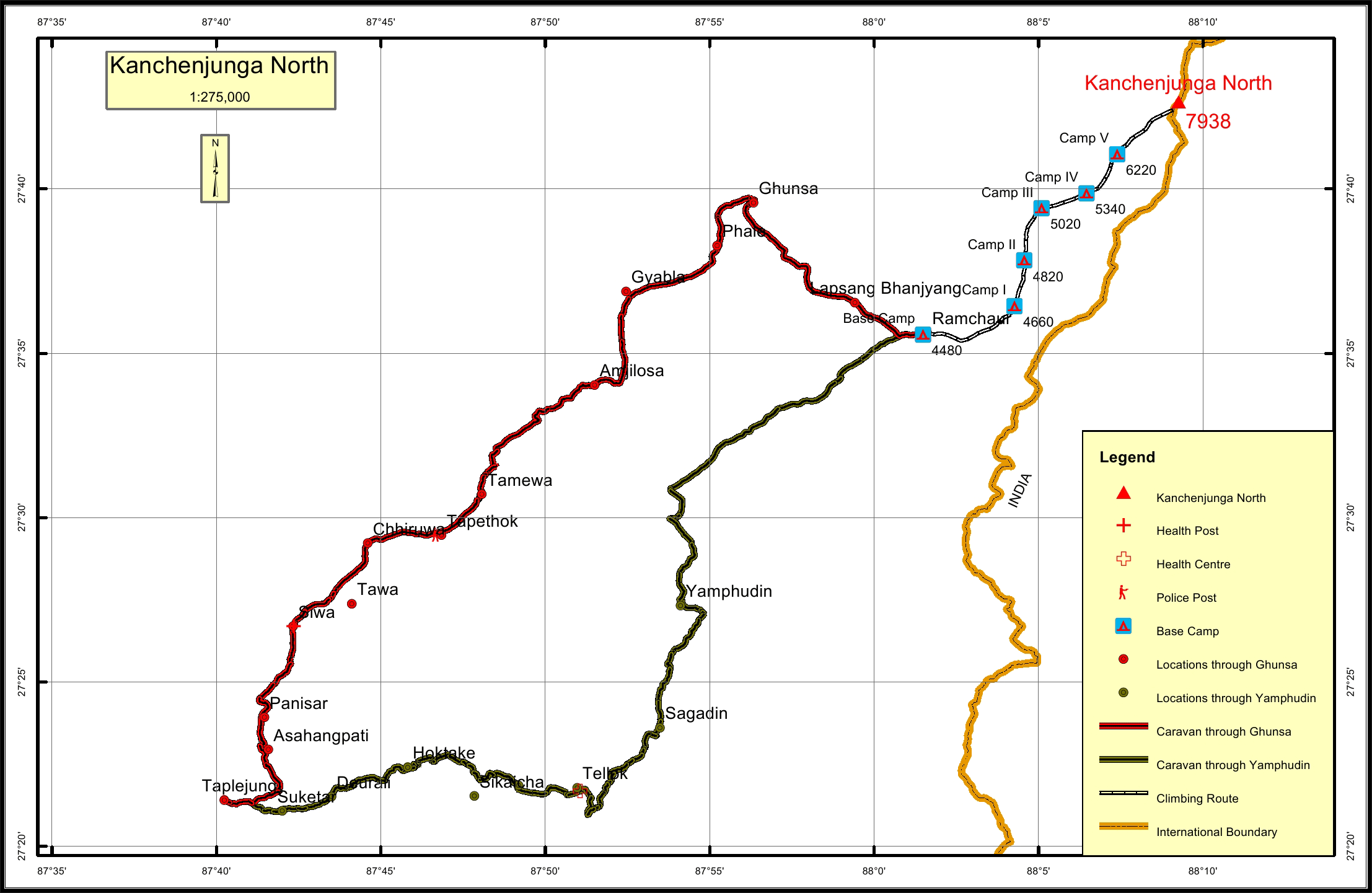
Kanchenjunga North Overview

Peak ID

KANN

Status

Opened

Elevation

7938 M / 26043 FT

Latitude

27° 42'39

Longitude

88° 09'16

Mount Kanchenjunga North, is in the Kanchenjunga mountain range of Nepal. Kanchenjunga North is on the border of Province I of Nepal and India. The elevation of Kanchenjunga North is 7,938 meters. It lies on the border of Phaktanglung rural municipality of Taplejung district of Nepal and India. Kanchenjunga North is the sixth highest peak of the Kanchenjunga mountain range of Nepal. Kanchenjunga North is 1.0 km north northeast of Kanchenjunga Main peak and 0.8 km south southwest of Khambachen East on the border ridge of Nepal and India.

Location

  • Province:

    Province 1
  • Mountain Range:

    Kanchenjunga
  • District:

    Taplejung/NI
  • Municipality/Rural Municipality:

    Phaktanglung/NI

Nearest help center

( from the basecamp along
the caravan route )
  • Police post:

    Tapethok 43.3KM
  • Armed police post

    Taplejung 67.2KM Taplejung 67.8KM
  • Army post:

    Taplejung 67.2KM Taplejung 67.8KM
  • Health centre/post:

    Tellok 44.1KM Siwa 53.6KM
  • Nearest settlement :

    Yamphudin 25.6KM Ghunsa 13.3KM

Royalty Fees

  • Nepalese (NRs):

    Sp 8000, Au 4000, Wi/Su 2000
  • Foreigners (USD):

    Sp 600, Au 300, Wi/Su 150

How to get there

  • From Kathmandu:

    Fly to Biratnagar or Bhadrapur and then by vehicle to Taplejung or by vehicle to Taplejung
  • Caravan route:

    Taplejung-Ghunsa-Lhonak-Pangpema-BC
  • Caravan route
    length:

    67.2KM through Yamphudin, 67.8KM through Ghunsa
  • Climbing route
    length:

    20.9KM
  • Duration:

    75 Days

Maps