Kanchenjunga South Overview
Peak ID
KANS
Status
Opened
Elevation
8476 M / 27808 FT
Latitude
27º 41' 32"
Longitude
88º 09' 23"
History
1st ascent on
May 19,1978
1st ascent by
Eugeniusz Chrobak,
Wojciech Wroz,
Wojciech Wroz,
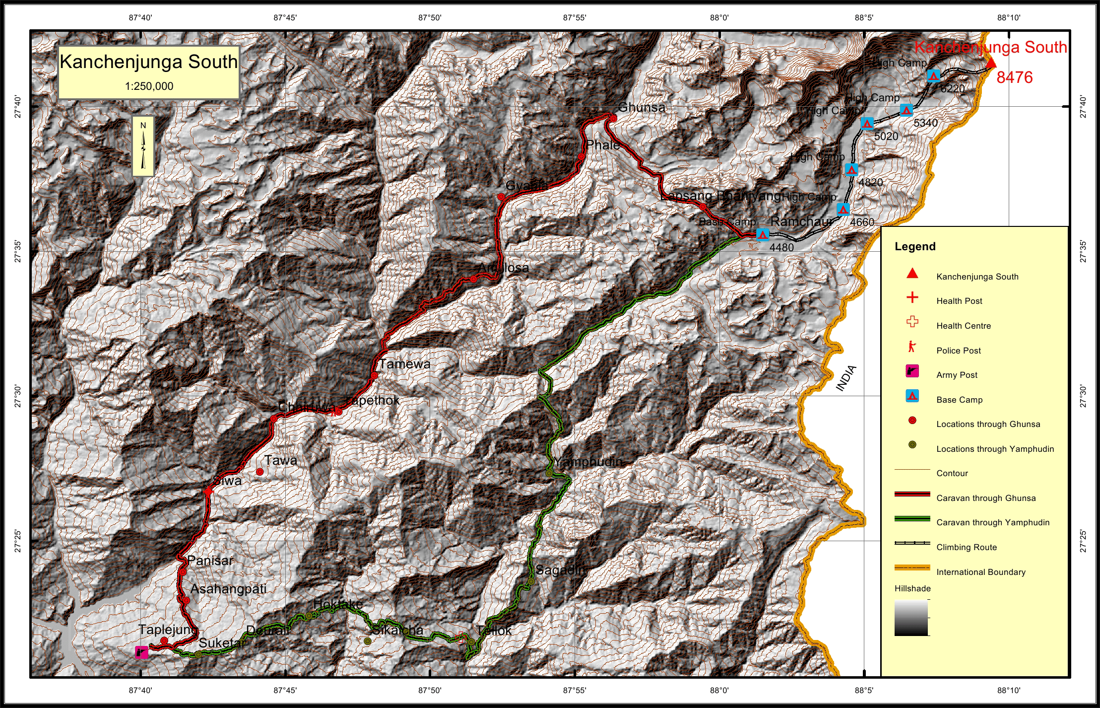
Location
Nearest help center
( from the basecamp alongthe caravan route )
Royalty Fees
How to get there
Maps
Four Faces
.jpg)
South Face from Pawa Bhanjyang
.jpg)