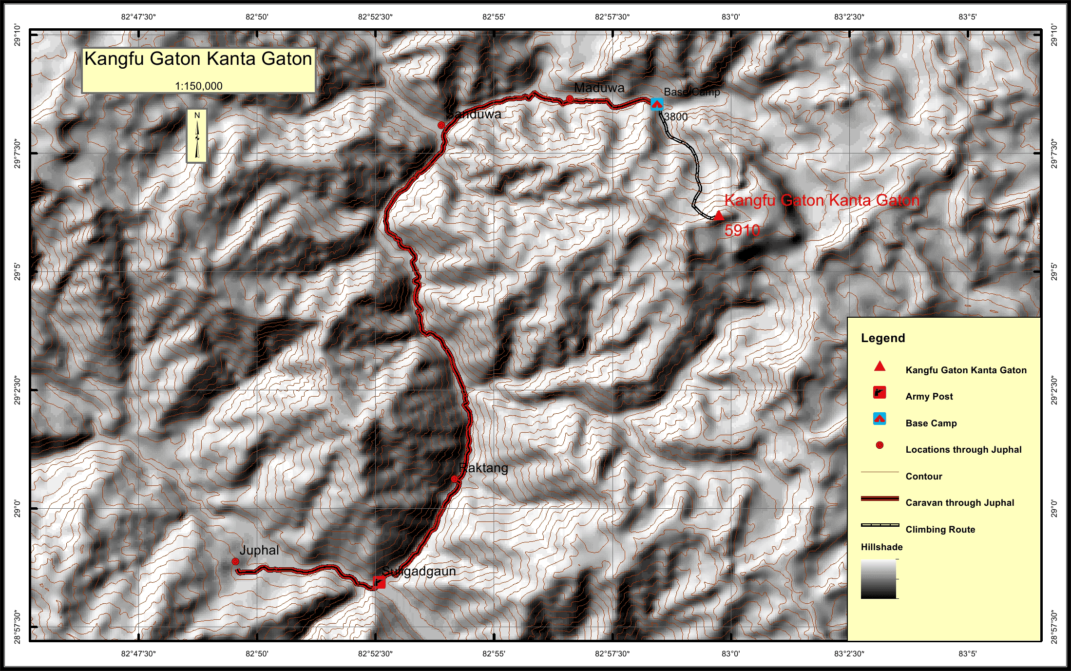
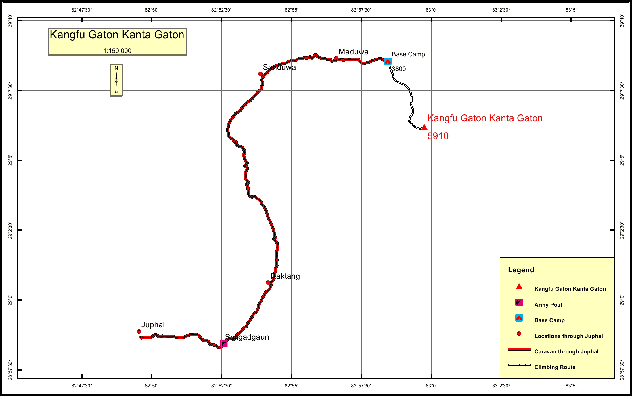
Kangfu Gaton Kanta Gaton Overview
Peak ID
KNGT
Status
Opened
Elevation
5916 M / 19390 FT
Latitude
29º 06'12"
Longitude
82º 59' 45"
History
1st ascent on
16 Aug, 2009 A.D
1st ascent by
Jean Rene Minelli,
Abel Minelli,
Eienne Minelli,
Sarah Minelli,
Pemba Jangbu Sherpa,
Abel Minelli,
Eienne Minelli,
Sarah Minelli,
Pemba Jangbu Sherpa,
Kangfu Gaton Kanta Gaton lies in Gautam Himal sub range of the Nepalese Himalayas and is located in Dolpa district of the Mid-Western Nepal.
Location
Nearest help center
( from the basecamp alongthe caravan route )
Royalty Fees
How to get there
Maps