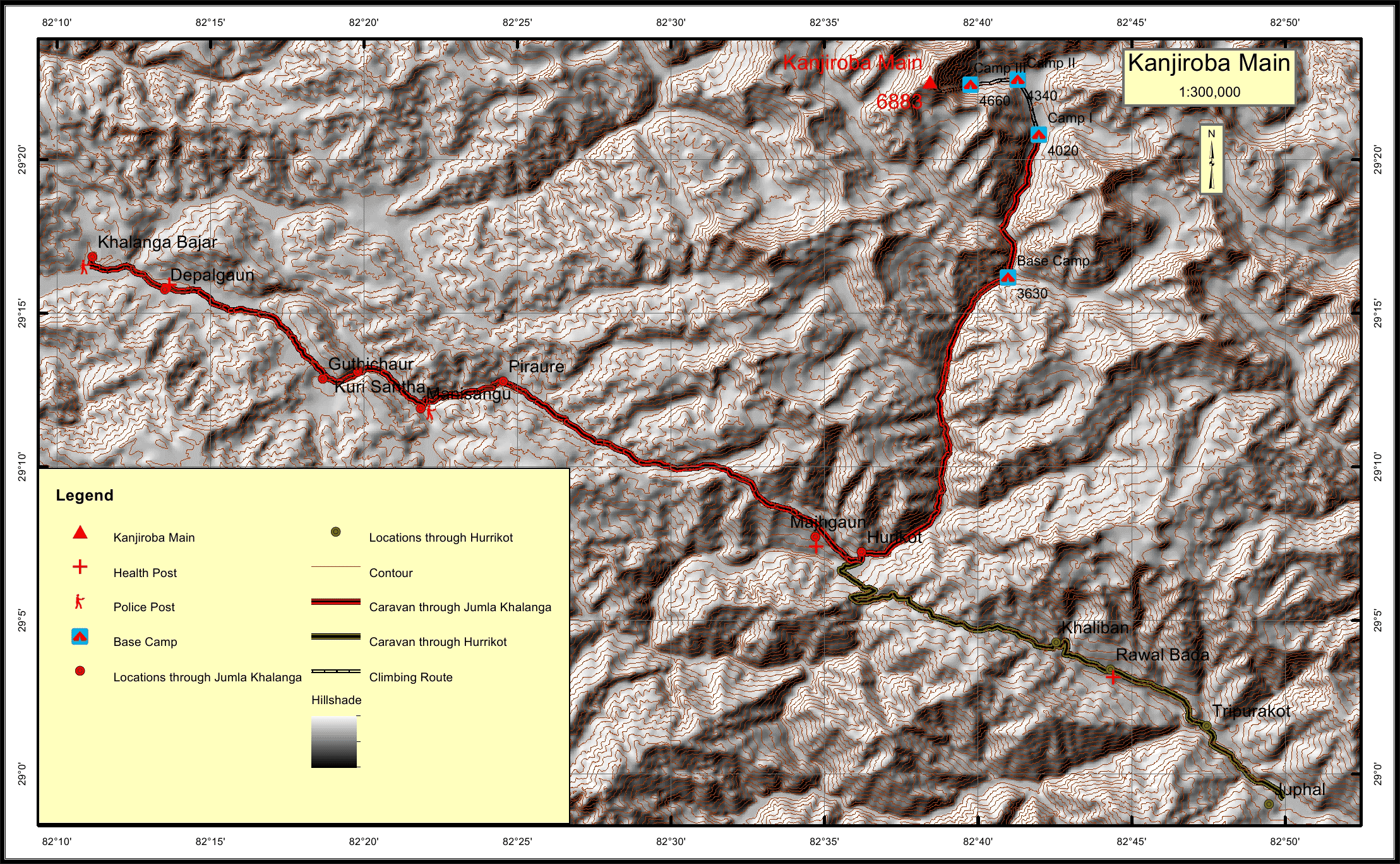
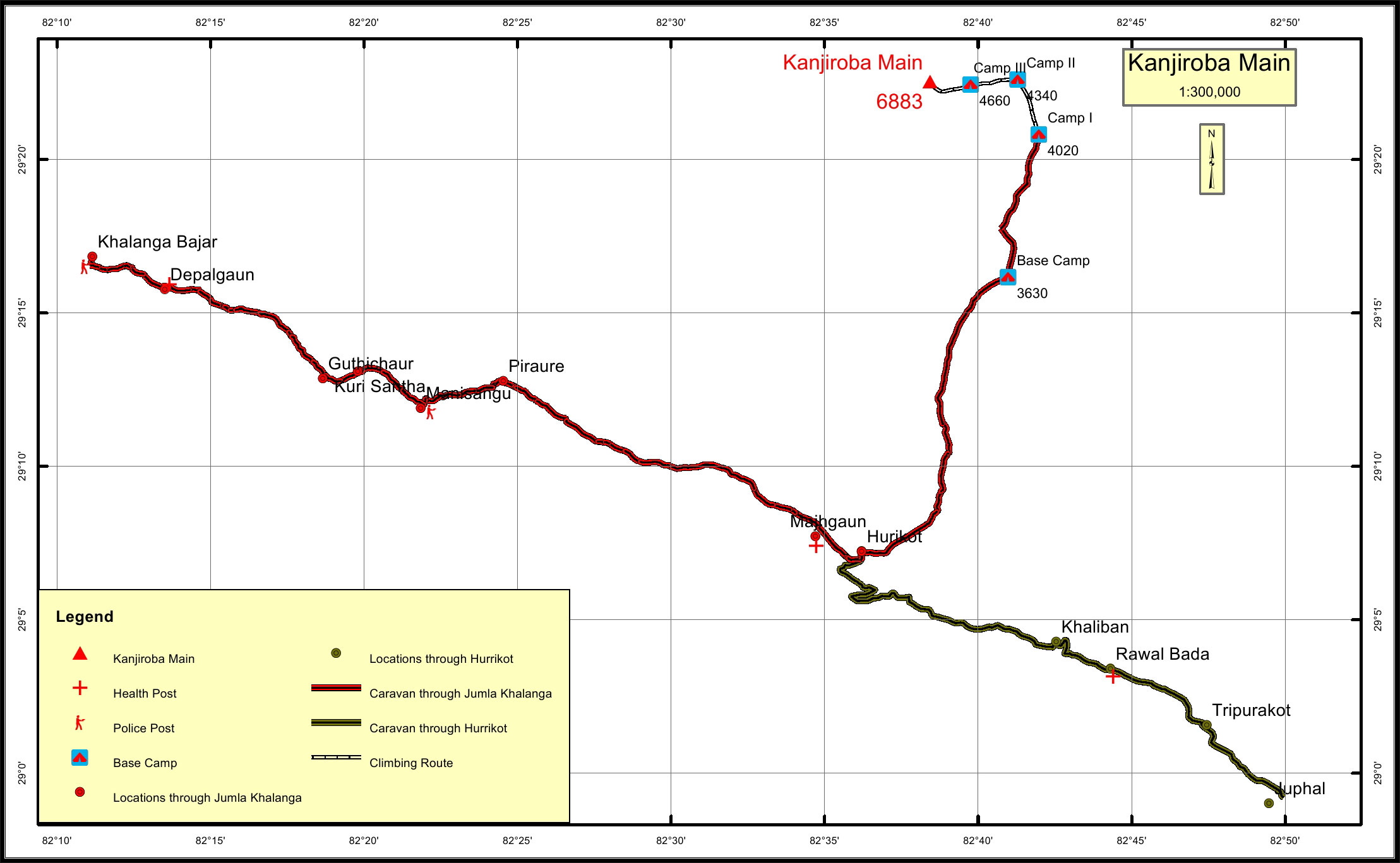
Kanjiroba Main Overview

Peak ID

KJRM

Status

Opened

Elevation

6883 M / 22582 FT

Latitude

29º 22' 32"

Longitude

82º 38' 26"

Kanjiroba is the main peak in Kanjiroba range of the Nepalese Himalayas. It is isolated range adjacent to the Tibetan border, lying in the western part of Nepal.Kanjiroba was not mapped until 1950, when John Baird, a British explorer made the first series expedition to this area.

Location

  • Mountain Range:

    Kanjiroba
  • District:

    Dolpa
  • Municipality/Rural Municipality:

    Jagdulla

Nearest help center

( from the basecamp along
the caravan route )
  • Police post:

    Jumla 82.5KM Mani Sangu 59.6KM
  • Health centre/post:

    Rawat Bada 53.8KM Majhgaun 33.6KM
  • Nearest settlement :

    Hurikot 30.4KM

Royalty Fees

  • Nepalese (NRs):

    Sp 5000, Au 2500, Wi/Su 1250
  • Foreigners (USD):

    Sp 400, Au 200, Wi/Su 100

How to get there

  • From Kathmandu:

    By flight to Nepalganj and Jumla Khalanga
  • Caravan route:

    Juphal- or Jumla-Hurrikot-Jagdul Col- des Anglais-BC
  • Caravan route
    length:

    82.8KM m through Jumla Khalanga, 66.3KM through Juphal
  • Climbing route
    length:

    8.4KM
  • Duration:

    50 Days

Maps