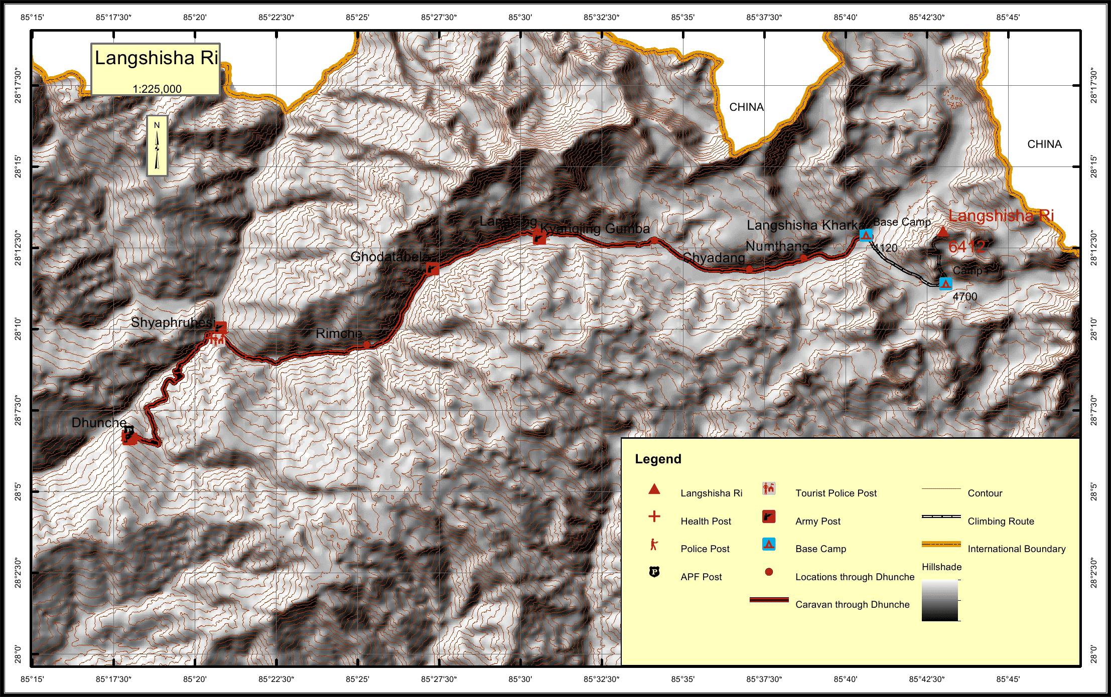
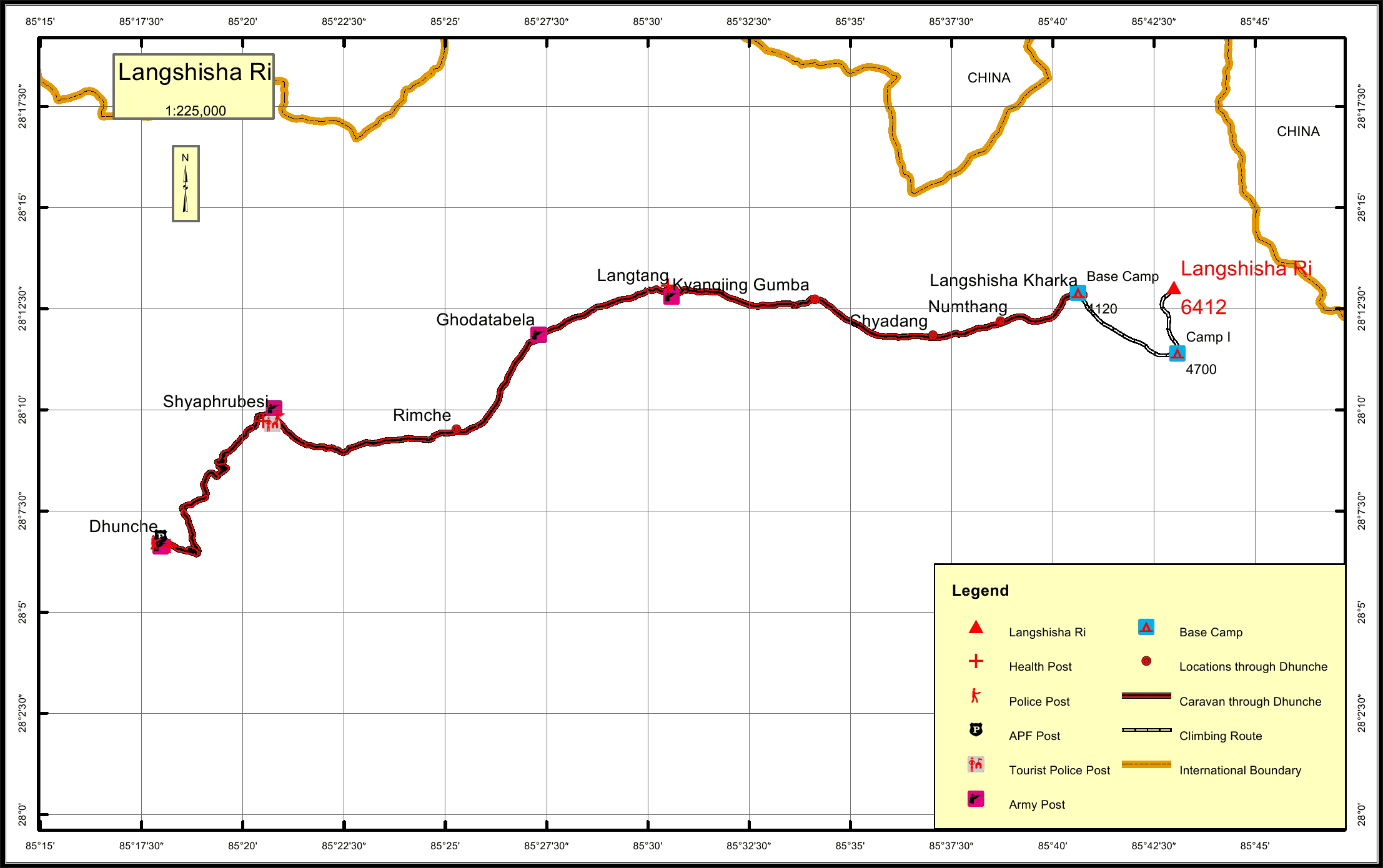
Langshisha Ri * Overview

Other Name

Langsisa Ri

Peak ID

LSIS

Status

Opened

Elevation

6412 M / 21037 FT

Latitude

28º 13' 01

Longitude

85º 42' 59

Managed By

NMA

History

1st ascent on

23 Apr, 1982 A.D

1st ascent by

Takuya Kajimoto,
Pasang Norbu Sherpa,

Langsisa Ri used to be a full expedition peak until the Government of Nepal put it under the control of the NMA in 2002. It is situated in the popular Langtang trekking region and is a technically challenging peak being perhaps one of the most difficult of the trekking peaks after Kusum Kanguru. Langsisa Ri is ideal for those who want a Himalayan expedition-style challenge with a very simple, affordable permit system. Langtang also has the advantage of quick access from Kathmandu with plenty of small peaks to explore and acclimatize on.

Location

  • Province:

    Bagmati Pradesh
  • Mountain Range:

    Jugal
  • District:

    Rasuwa
  • Municipality/Rural Municipality:

    Gosai Kunda

Nearest help center

( from the basecamp along
the caravan route )
  • Police post:

    Syaphrubesi 38.8KM
  • Armed police post

    Dhunche 52.9KM
  • Army post:

    Langtang 18.2KM
  • Health centre/post:

    Langtang 18.2KM
  • Tourist police post:

    Syaphrubesi 38.8KM
  • Nearest settlement :

    Numthang 3.8KM

Royalty Fees

  • Nepalese (NRs):

    Spring 4000, Autumn 2000, Winter/Summer 1000
  • Foreigners (USD):

    Spring 250, Autumn 125, Winter/Summer 70

How to get there

  • From Kathmandu:

    Drive to Shyaphrubesi
  • Caravan route:

    Dhunche-Kyanging-BC
  • Caravan route
    length:

    52.9KM through Dhunche
  • Climbing route
    length:

    8.5KM
  • Duration:

    19 Days

Maps