Langtang Lirung Overview
Other Name
Nandanli
Peak ID
LANG
Status
Opened
Elevation
7234 M / 23711 FT
Latitude
28º 15' 22
Longitude
85º 31' 10
History
1st ascent on
Oct 24,1978
1st ascent by
Seishi Wada ,
Pemba Tsering Sherpa,
Pemba Tsering Sherpa,
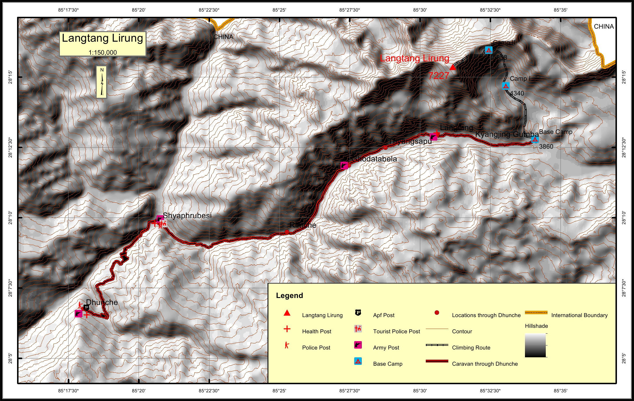
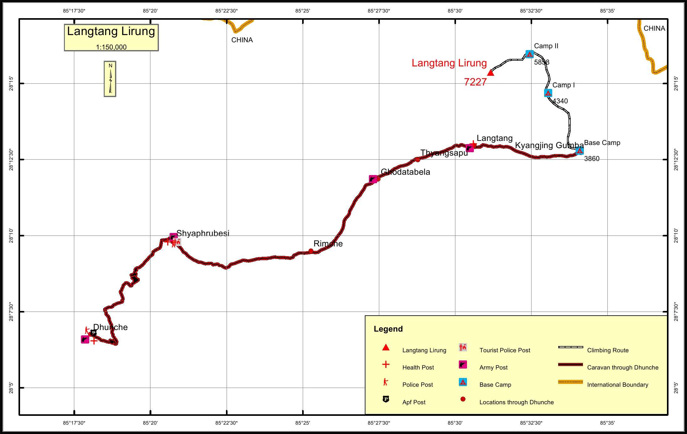
Langtang Lirung is the highest peak of the Langtang Himal, which is the sub range of the Nepalese Himalaya, southwest of the Eight thousander Shishapangma. It forms the western portion of a complex of mountain This complex lies between the Sun Kosi Valley on the east and the Trisuli Gandaki Valley on the west. It lies near the Trisuli Gandhaki and north of the Langtang Khola. Langtang Lirung is very beautiful and excellent massive view of Langtang range. Langang Lirung is clearly visible from Kathmandu. It is situated just 35 km as the crow fly distance north of Kathmandu.
Location
Nearest help center
( from the basecamp alongthe caravan route )
Royalty Fees
How to get there
Maps