Lho Tse Shar Overview
History
Mount LhoTse Shar is the subsidiary mountain of Lhotse, located to the south
of Mt. Everest. It is 11 th highest peak on Earth. The peak elevates to a height of
8,400 m. Mount LhoTse Shar lies in Khumjung Village Development
Committee under Khumbu Pasang Lhamu rural municipality of Solukhumbu
District in Eastern Development Region of Nepal. It is open for expeditions. It
takes approximately 56 days to climb LhoTseShar. A flight to Lukla is the
entry point for LhoTse Shar. Josef Mayerl and Rolf Walter were the first to
ascendit successfully on May 12, 1970.
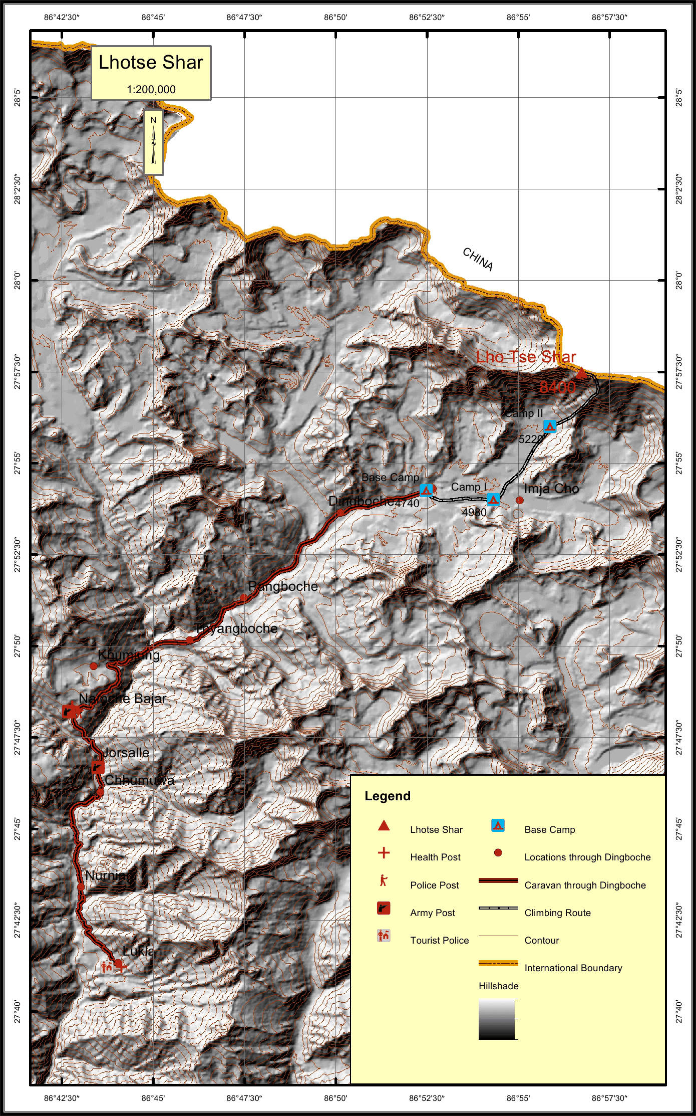
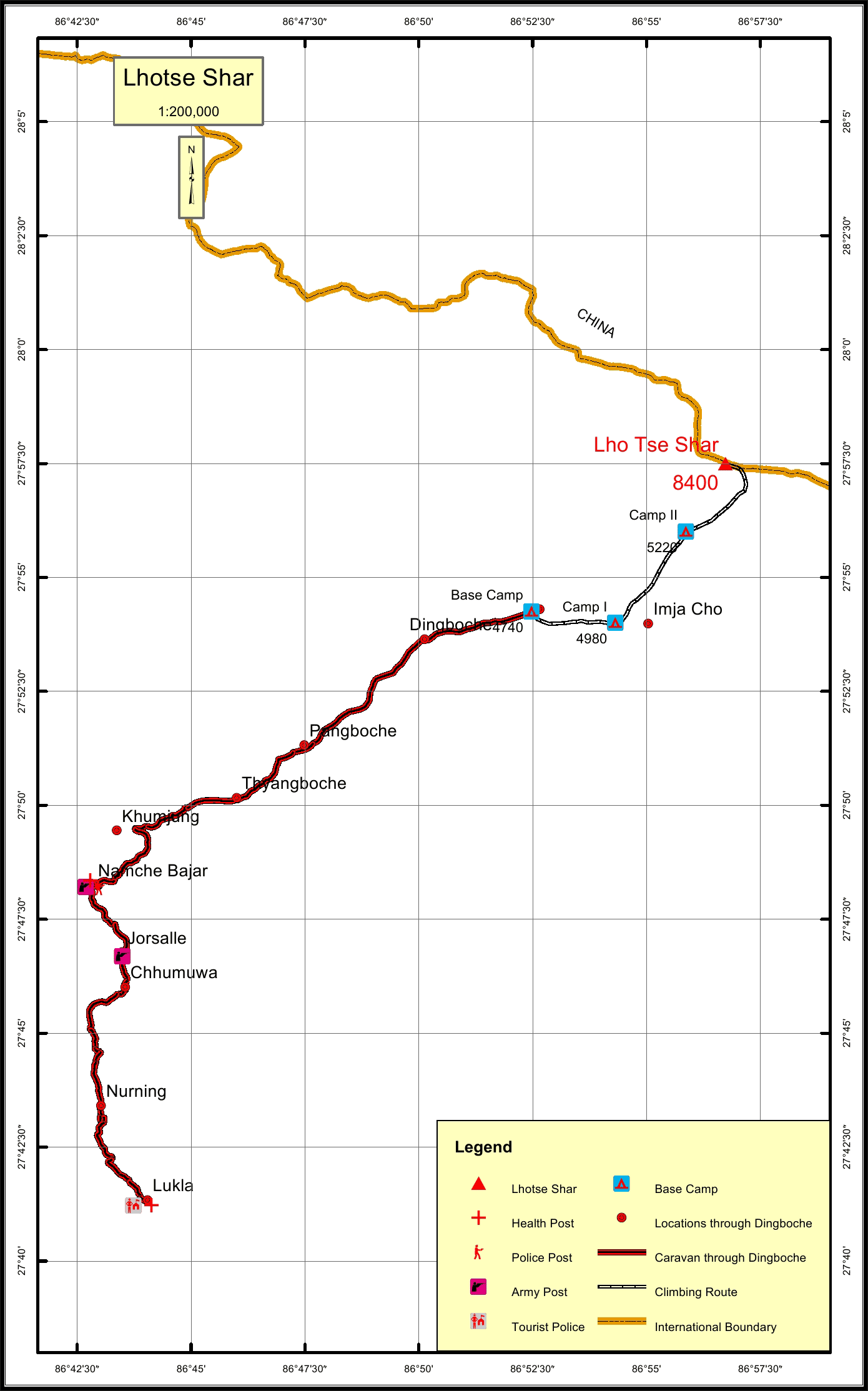
The caravan route for LhoTse Shar begins from Lukla to Jorsalle to Namche to
Khumjung to Pangboche to Dingboche and finally to the Base Camp. The total
distance of the caravan route through Dingboche is 39.1 km. The total climbing
route length is 12.1 km.
The nearest settlement to the peak is Dingboche at a distance of 3.8 km. The
nearest army, police and health postsare in Namche which is locatedat a
distance of 22.1 km. The nearest tourist post to the peak is 39.1 km away at
Lukla.
Location
Nearest help center
( from the basecamp alongthe caravan route )


.jpg)
.jpg)


