Home
About
About Peak Profile
NHPP Committee
Our Staffs
Peak Profile
All Peaks
5800m - 6499m Peaks
6500m - 6999m Peaks
7000m - 7499m Peaks
7500m - 7999m Peaks
Above 8000m Peaks
Contact
Home
About
About Peak Profile
NHPP Committee
Our Staffs
Peak Profile
All Peaks
5800m - 6499m Peaks
6500m - 6999m Peaks
7000m - 7499m Peaks
7500m - 7999m Peaks
Above 8000m Peaks
Contact
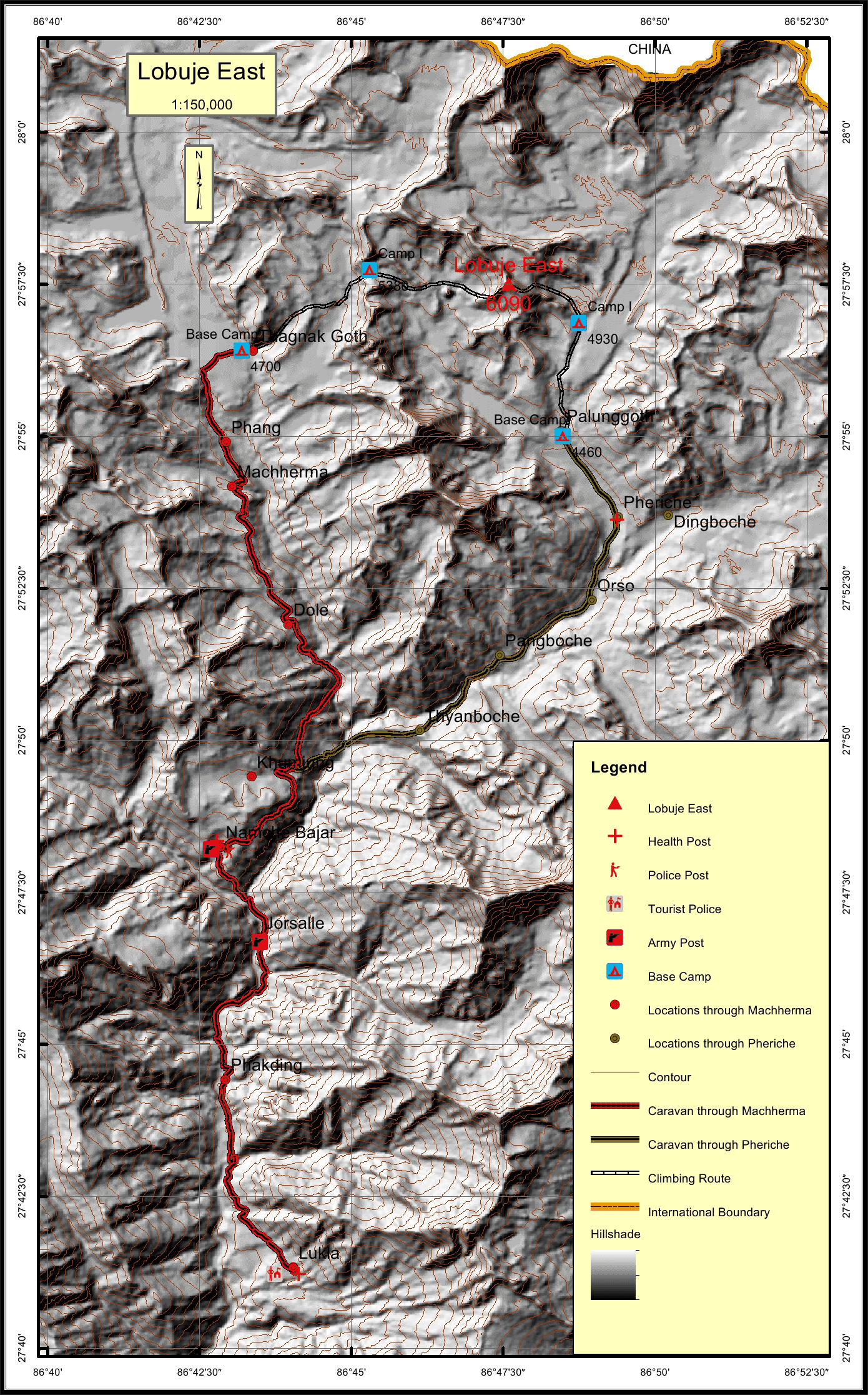
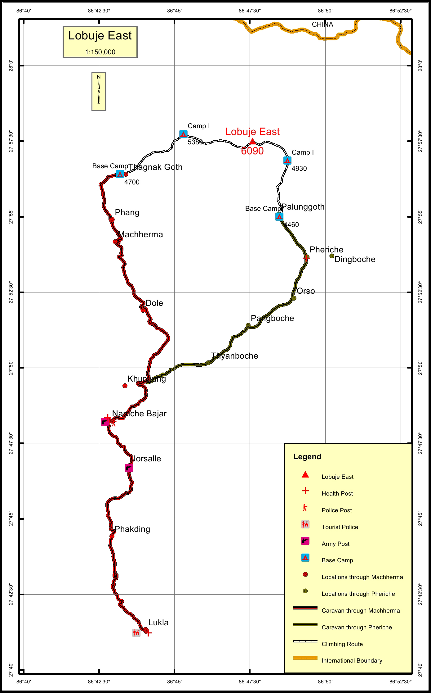
Lobuje East * Overview
Peak ID
LOBE
Status
Opened
Elevation
6090 M / 19980 FT
Latitude
27º 57' 30"
Longitude
86º 47' 35"
Managed By
NMA
History
1st ascent on
25 Apr, 1984 A.D
1st ascent by
Larry Nielson,
Any Gyaltsen Sherpa,
Lobuje peak has two summits East and West. While Lobuje East is recognized for trekking Lobuje West is known for Expedition.
Location
Province:
Province 1
Mountain Range:
Khumbu
District:
Solukhumbu
Municipality/Rural Municipality:
Khumbu Pasang Lhamu
Nearest help center
( from the basecamp along
the caravan route )
Police post:
Namche 21.1KM Namche 20.4KM
Army post:
Namche 21.1KM
Health centre/post:
Pheriche 2.7KM Namche 21.1KM
Tourist police post:
Lukla 38.2KM Lukla 36.8KM
Nearest settlement :
Phang 3.9KM 2.7KM
Royalty Fees
Nepalese (NRs):
Rs.1000 in Summer and Winter, Rs.2000 in Autumn and seasons and Rs.4000 in Spring.
Foreigners (USD):
$70.00 in Summer and Winter, $125.00 in Autumn and $250.00 in Spring
How to get there
From Kathmandu:
Flight to Lukla
Caravan route:
Lukla-Namche-Khumjung-Lobuche-BC/Gokyo-Dzonghla-BC
Caravan route
length:
38.2KM through Machherma, 36.8KM through Pheriche
Climbing route
length:
6.4KM through Pheriche, 8.7KM through Machherma
Duration:
14 Days
Maps
Nepal Himal Peak Profile
Discover the information about mountains in Nepal.
Select All
Province
District
Municipality/Rural Municipality
Himalayan Range
Select All
Secriteriate And Technical Support:
© Copyright Nepal Government. All rights reserved.
Website by
Curves n'Colors