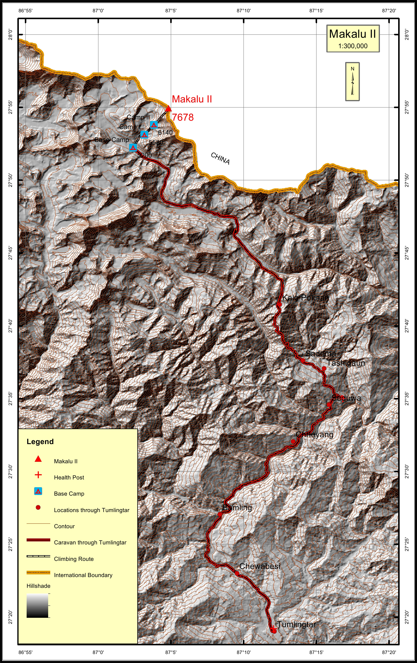
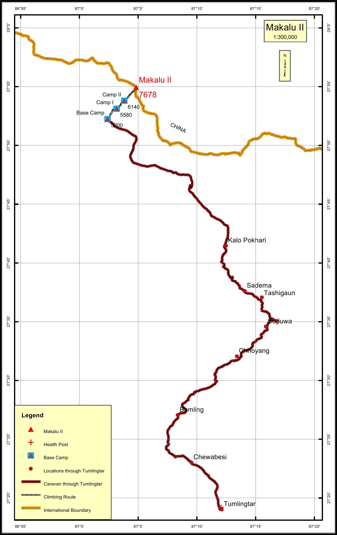
Makalu II (Kangchug Tse) Overview
Other Name
Kangchhungtse
Peak ID
MAK2
Status
Opened
Elevation
7678 M / 25190 FT
Latitude
27º 54' 56"
Longitude
87º 04' 50"
History
1st ascent on
Oct 22,1954
1st ascent by
Jean Franco,
Lionel Terray,
Gyaltsen Norbu Sherpa,
Pa Norbu Sherpa,
Lionel Terray,
Gyaltsen Norbu Sherpa,
Pa Norbu Sherpa,
Lorem Ipsum is simply dummy text of the printing and typesetting industry. Lorem Ipsum has been the industry's standard dummy text ever since the 1500s, when an unknown printer took a galley of type and scrambled it to make a type specimen book. It has survived not only five centuries, but also the leap into electronic typesetting, remaining essentially unchanged. It was popularised in the 1960s with the release of Letraset sheets containing Lorem Ipsum passages, and more recently with desktop publishing software like Aldus PageMaker including versions of Lorem Ipsum
Location
Nearest help center
( from the basecamp alongthe caravan route )
Royalty Fees
How to get there
Maps