Sagarmatha
 8848.86 M / 29032 FT
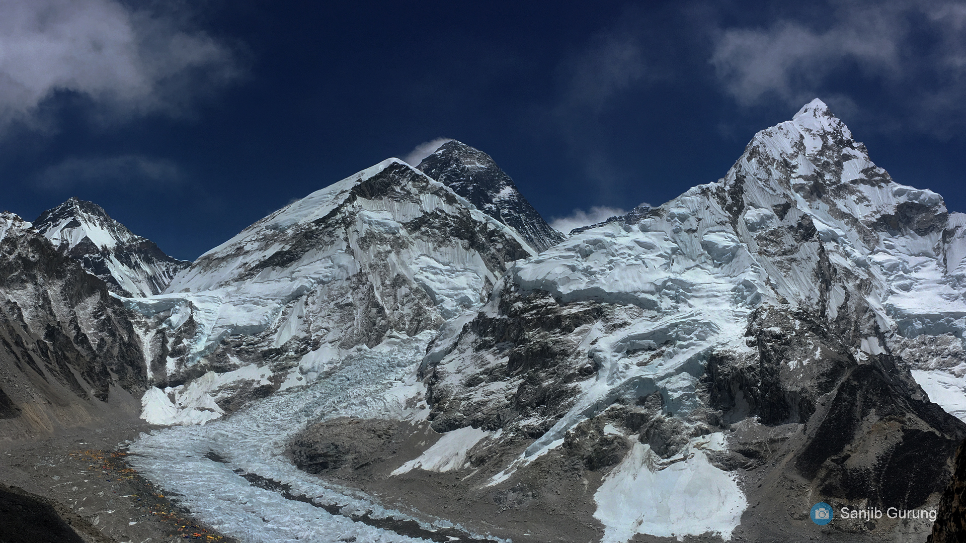
Mount Everest has long been revered by the local people. It has the most
common Tibetan name, Chomolungma, meaning “Goddess Mother of the
World” or “Goddess of the Valley.” The Sanskrit or Nepali name
“Sagarmatha” literally means “Peak of Heaven.” Its identity as the highest
point on the Earth’s surface was not recognized until 1852. The fact was
revealed by the governmental Survey of India in 1852. In 1865, the mountain
referred to as Peak XV was renamed as Mount Everest in honour of Sir
George Everest, the British surveyor general of India from 1830 to 1843.
Mount Everest is part of the longest Himalayan range, Mahalangur range, of
the Nepal Himalayas. It is at an elevation of 8,848 m in Khumjung Village
Development Committee under Khumbu Pasang Lhamu rural municipality in
Solukhumbu District in Eastern Development Region of Nepal. It is open for
expeditions. It takes approximately 84 days to summit the peak. A flight to
Lukla is the entry point for Sagarmatha. Sir Edmund Hillary and Tenzing
Norgay Sherpa were the first to ascent the highest peak on May 29, 1953.
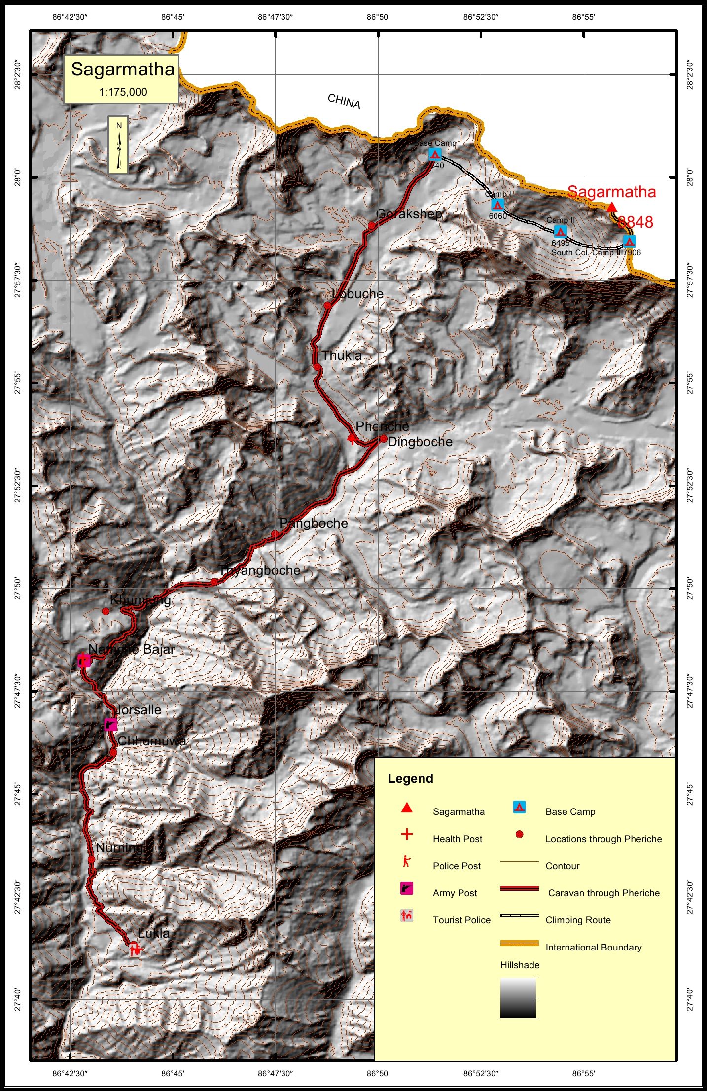
The caravan route for Sagarmatha begins from Lukla to Jorsalle to Namche to
Khumjung to Pheriche to Lobuche to Gorakshep and finally to the Base Camp.
The total distance of the caravan route through Pheriche is 51.2 km. The total
climbing route is 11.2 km. The nearest settlement to Sagarmatha is Lobuche at
a distance of 8.3 km. The nearest police post and army post are at Namche at a
distance of 34.1 km. The nearest health post is located at Pheriche which is
51.2 km from Sagarmatha. The nearest tourist post to the peak is situated at
Lukla which is 51.2 km away.
Map
How to get there
Itinerary
Remarks
Everest remained a difficult Mountain to climb for decades even after series of attempts by professional climbers and large national expedition until the commercial era began in 1990.
Nepal Himal Peak Profile
Secriteriate And Technical Support:
© Copyright Nepal Government. All rights reserved.
Website by Curves n'Colors
Website by Curves n'Colors