Yalung Khang Overview

Other Name

Yalungkar

Peak ID

YALU

Status

Opened

Elevation

8505 M / 27903 FT

Latitude

27º 42' 18"

Longitude

88º 08' 19"

History

1st ascent on

May 14,1973

1st ascent by

Yutaka Ageta,
Takao Matsuda,

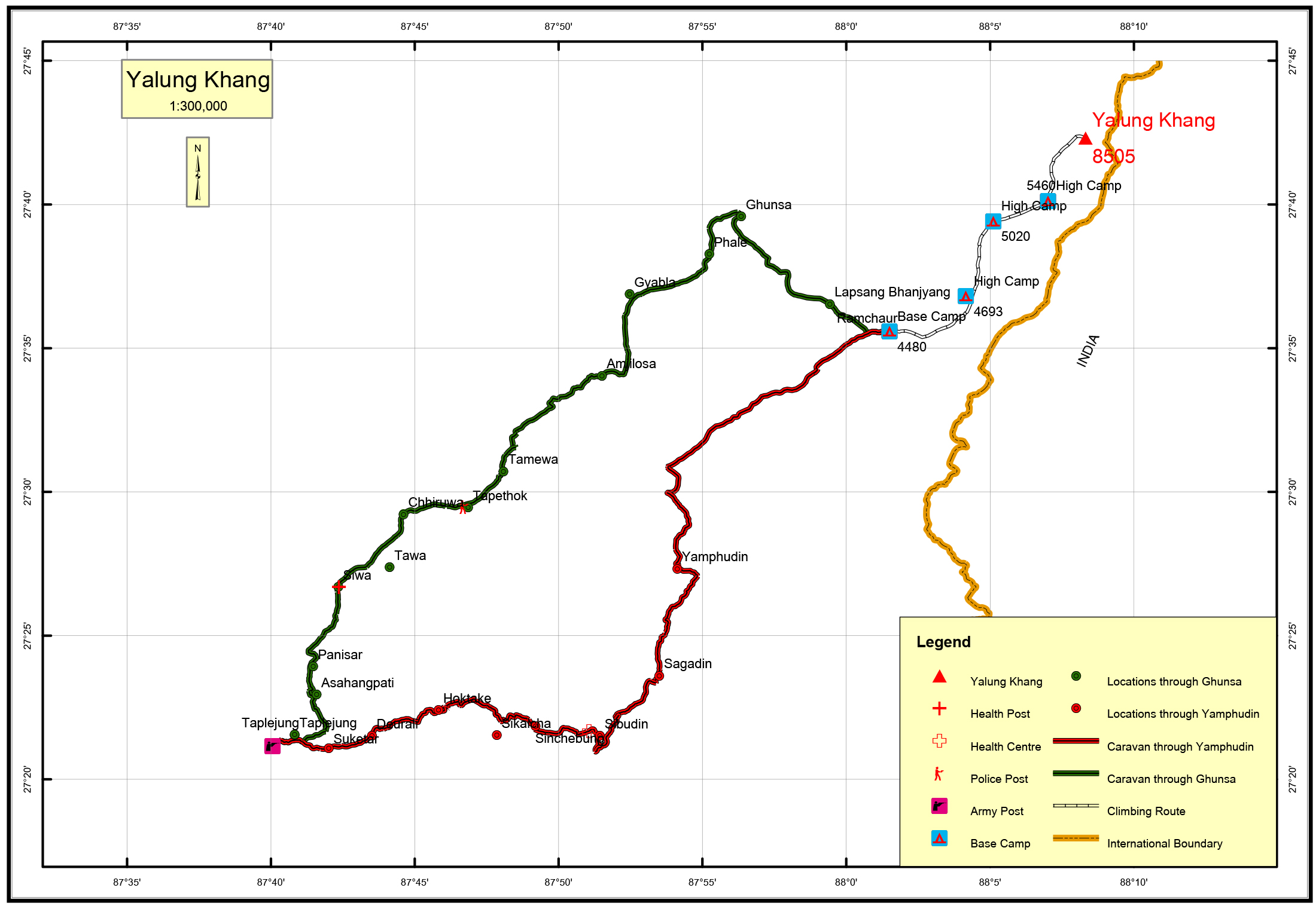
Mount YalungKhang is situated in the Kanchenjunga mountain range of Nepal. YalungKhang is in Phaktanglung rural municipality of Taplejung district. The elevation of YalungKhang is 8,505 meters. It is the 2nd highest peak on the Kanchenjunga mountain range of Nepal. YalungKhang is 1.1 km west northwest of Kanchenjunga Main peak and 1.3 km east of YalungKhang West.

Location

  • Province:

    Province 1
  • Mountain Range:

    Kanchenjunga
  • District:

    Taplejung
  • Municipality/Rural Municipality:

    Phaktanglung

Nearest help center

( from the basecamp along
the caravan route )
  • Police post:

    Tapethok 43.3KM
  • Armed police post

    Taplejung 67.2KM Taplejung 67.8KM
  • Army post:

    Taplejung 67.2KM Taplejung 67.8KM
  • Health centre/post:

    Tellok 44.1KM Siwa 53.6KM
  • Nearest settlement :

    Yamphudin 25.6KM Ghunsa 13.3KM

Royalty Fees

  • Nepalese (NRs):

    Spring 10000, Autumn 5000, Winter/Summer 2500
  • Foreigners (USD):

    Spring 1800, Autumn 900, Winter/Summer 450

How to get there

  • From Kathmandu:

    Fly to Biratnagar or Bhadrapur and then by vehicle to Taplejung or by vehicle to Taplejung
  • Caravan route:

    Taplejung-Yamphudin--Tseram-Ramche-Oktang-BC
  • Caravan route
    length:

    67.2KM through Yamphudin, 67.8KM through Ghunsa
  • Climbing route
    length:

    20KM
  • Duration:

    75 Days

Maps

Four Faces

West Face from Lumba Sumba

North Face from Tengoma BC

South face from Pewa Bhanjyang